Satellite imagery could improve fossil-hunting at remote sites

Satellite imagery could help paleontologists spot promising fossil sites before trekking into remote places.
New research from the lab of UO paleontologist Edward Davis in the Department of Earth Sciences shows that satellite data can reveal large individual fossils from the air, allowing field researchers to embark on more targeted searches on the ground.
Their findings were published Nov. 28 in the journal Geological Magazine.
"Organizing field work is very expensive, and there are lots of safety and security risks," said Elena Ghezzo, who led the work as a postdoctoral researcher in Davis' lab. "So any additional information you can have from the field before you go is useful. My method seems be really good at ruling out regions that don't have fossils."
The team analyzed multispectrum satellite imagery, which includes not just visible light, but also other wavelengths like ultraviolet and infrared. By looking at how all these different types of light are absorbed or reflected by the landscape, researchers can pick out specific features, like fossils, from the background.
This kind of satellite data is often used to do aerial surveys of cities and track patterns of land use. But it hasn't been used before to search for single fossils, Ghezzo said.
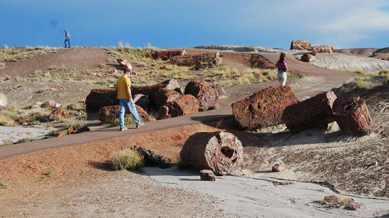
The researchers tested their idea with data from Petrified Forest National Park in Arizona.
More than 200 million years ago, this landscape was a lush coniferous forest. Today, it's a colorful desert, dotted with fossilized logs. Based on a reference map they created by hand, the researchers could identify the signatures in the satellite data that distinguished a fossil from the background or from other landscape features.
To be picked out via satellite, a fossil must be bigger than a single pixel in the image. And its mineral composition must respond differently to light than the surrounding material. It's easier when the landscape is flat and open, with relatively few obstructions, as the Petrified Forest is. But other data about the geology and topography of the region can also be factored in, to help researchers distinguish a fossil from, say, a tree or a big rock.
Ghezzo collaborated with Davis' lab via a Marie Skłodowska-Curie global fellowship, an award that funds early-career researchers at European institutions to pursue independent research projects abroad. She's now testing the technique on a variety of fossil sites around the world, from Peru to Egypt to Mongolia.
And closer to home, Davis is particularly interested in applying the approach to some of his team's field sites in Eastern Oregon.
In much of Eastern Oregon, fossils are scattered across vast remote expanses. Parts of the land, like the John Day Fossil Beds, are designated wilderness. Motorized vehicles are prohibited, so fossils must be found on foot.
"There's a lot of places in the interior of Oregon that are very difficult to access even today," Davis said. "Having the ability to use aerial photography to find fossils could help us allocate our resources."
Bigger picture, a technique of this kind could be part of a shift within the field of paleontology. The practices of the past, which included blowing up hillsides with dynamite, have, in some cases, irreparably damaged the landscape. A new generation of paleontologists is working to make the field more sustainable and preserve the context in which fossils are found.
"We don't do a lot of digging anymore," Davis said. Instead, researchers often wait for fossils to be exposed by erosion, and then excavate in a more targeted manner. And satellite data can help them out.
More information: Elena Ghezzo et al, Multispectral satellite imaging improves detection of large individual fossils, Geological Magazine (2022). DOI: 10.1017/S001675682200108X
Provided by University of Oregon Using monkey teeth to hone dates of human fossils
No comments:
Post a Comment