Alexandra Mae Jones
CTVNews.ca writer
Thursday, October 7, 2021
Thursday, October 7, 2021

Lava from La Palma volcano creates new land
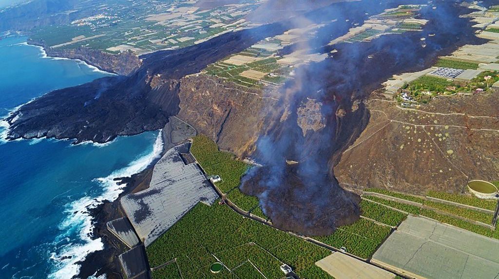
TORONTO -- Drone footage of the coast of the Spanish island La Palma shows just how far the lava flow from last month’s volcano eruption has extended, forming a new headland that juts out into the ocean.
In a video released this week, the lava’s progress is visible as two huge black trails, one curving off the side of the coast into the water in a large, black blob, and the other oozing down onto some farmland.
La Palma, which is part of the volcanic Canary Islands, suffered a volcanic eruption in mid-September, forcing the evacuation of more than 6,000 residents.
Since then, the slow path of the lava has carved through more than 900 houses and eradicated everything in its path.
The new land mass created by the lava off the coast is still visibly hot, with steam rising from its surface, but officials say the lava is slowing down.
The La Palma council tweeted on Oct. 6 that the volcano is stabilizing, and there’s been less seismic activity recently. They added that nearly 422 hectares have been affected by the lava runoff, which is 1.2 kilometres wide at its widest part.
More than 90 hectares of the affected land have crops, with banana plantations making up the largest percentage of affected farmland.
La Palma volcano update: Magnificent aerial image of new branch and delta
Fri, 8 Oct 2021, 03:05
03:05 AM | BY: MARTIN
Aerial photo shows the tongue (right) of the main lava (left) extending south-southwest direction (image: @RTVCes/twitter)
No comments:
Post a Comment