Tuesday, November 30, 2021

As new vents open in La Palma, experts say volcanic eruption could be longest in 500 years

Lava flow is affecting previously spared areas of the Spanish island, while an increase in tremors and emissions suggests the volcano is becoming more active


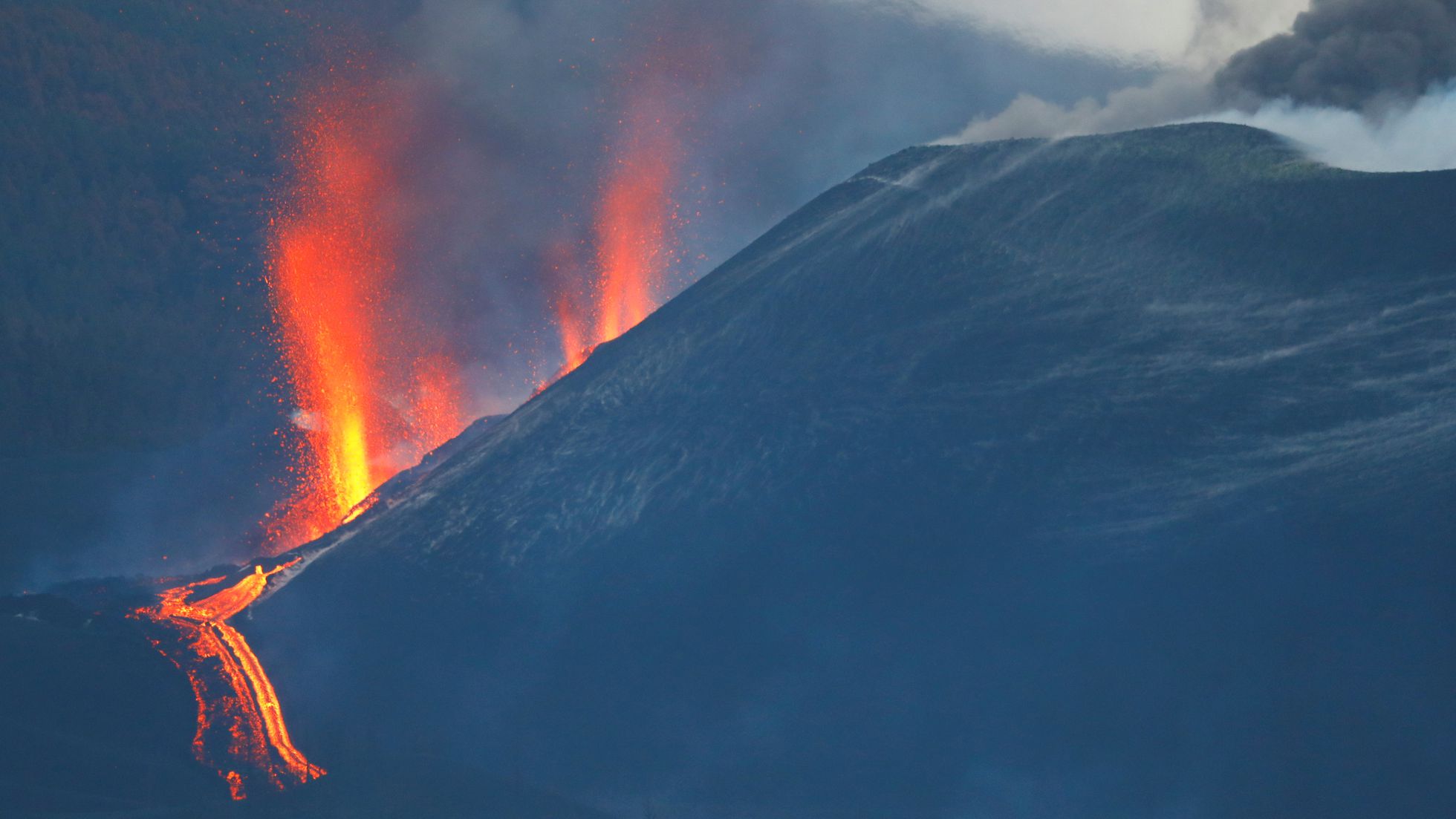
The volcano in La Palma seen from the observation point in Tajuya.
VÍDEO: INVOLCAN (BORJA SUAREZ (REUTERS))
GUILLERMO VEGAEL PAÍS

Santa Cruz de La Palma - NOV 29, 2021 - 05:21 CST

For residents of the Spanish island of La Palma, Monday brought little hope that the volcano in Cumbre Vieja natural park will go quiet any time soon.

The volcanic eruption in this corner of the Canary Islands, located off the northwestern coast of Africa, entered its 72nd day with no signs of letting up. In fact, experts now believe it has a good chance of becoming La Palma’s longest eruption in 500 years.

MORE INFORMATION
La Palma volcano in numbers: €700m in damages, 5,100 quakes and 7,000 evacuated

“Unfortunately, the forecast contemplates no short-term end,” said Francisco Prieto, a technician for the team of experts monitoring the eruption, the Volcano Risk Prevention Plan of the Canary Islands (Pevolca). Prieto said the current eruption could potentially last longer than the one that took place in 1646, when the Tehuya volcano spewed lava and ash for 84 days.

Experts also warned that new vents have opened up in recent hours and that new lava channels are flowing down in a northeast direction, affecting areas of the island that had so far been spared.
On Sunday, the Pevolca also issued a warning about the “very unfavorable” air quality in the municipalities of Tazacorte, Los Llanos de Aridane and El Paso, and urged residents to avoid outdoor activities whenever possible. The warning was caused by a rise in emissions of sulfur dioxide (SO₂), one of the metrics used by volcanologists to estimate how long an eruption will last. These emissions shot up to between 30,000 and 49,999 tons a day. According to Pedro Hernández, an expert with the Volcanology Institute of the Canary Islands (Involcan), “we may begin to see a light at the end of the tunnel when we get several days at hundreds of tons, instead of thousands.”

Two other indicators – earthquake activity and vibration caused by the flow of gas and magma – are also showing higher values. The National Geographic Institute (IGN) on Monday reported 43 recent tremors in La Palma; the strongest one measured 3.5 on the Richter scale and was recorded at a depth of 11 kilometers in the municipality of Fuencaliente.

Flights resumed

Meanwhile, commercial flights that had been grounded for a week resumed again over the weekend after cleaning crews removed the buildup of ash on the runway. The National Security Department said the cloud of ash and SO₂ is expected to keep moving in a west-southwest direction for the next 24 to 48 hours, a scenario that would help the airport remain operative.

Last week, hundreds of La Palma residents with serious medical conditions were unable to travel to the larger islands for treatment because of the airport closures and the fact that ferry tickets had been sold out. Part of the high demand for air and sea travel is caused by the large influx of tourists coming to see the eruption. The head of the La Palma island authority, Mariano Hernández Zapata, has announced that ferry operators doing routes between La Palma, Tenerife and Gran Canaria will reserve spots for local residents traveling on essential business.

New lava flows


The IGN reported that its observation station at Tajuya, in El Paso, recorded several new vents on the northeast face of the volcano at around 3am on Sunday. These vents were spewing lava and pyroclastic material, said IGN volcanologist Rubén López.

The new flows are largely covering land already affected by the lava in the area of Tacande, in the municipality of Los Llanos de Aridane, but the molten rock is also coming near Todoque mountain and could affect the town of La Laguna, said María José Blanco, a volcanologist with IGN.

On Sunday afternoon, Pevolca experts said that lava from one of the new tongues had crossed the LP-212 road and was already covering previously unaffected land.

Local authorities have closed off the northern access to the exclusion zone due to the increasingly adverse conditions. The southern access was sealed off last week because of a new vent that formed on Thursday, coupled with strong rains and bad air quality.

Booming lottery sales

A line of people waiting to buy lottery tickets in Los Llanos de Aridane on November 19.ALBERT GARCIA (EL PAÍS)

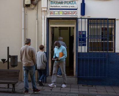
Residents of La Palma struggling with the effects of the volcanic eruption, which has already caused damage worth over €700 million to buildings, crops and family businesses, are hoping for a bit of good luck this year in Spain’s Christmas lottery, known as El Gordo (or, The Fat One). Sales of lottery tickets on the island have doubled and in some cases tripled, said workers at the three main sales offices.

“We’ve nearly tripled our sales since the volcano exploded,” said Alfonso Cabrera, who is in charge of the Tajurgo lottery sales point, in the heart of Santa Cruz de La Palma. “We’ve been getting a lot of local buyers and also a lot of tourists who want to take home tickets from La Palma.”

“People believe that where there’s been a calamity, that’s where the winning lottery number will be sold,” said Borja Muñiz, president of the industry group ANAPAL.
Oldest-known fossils of mysterious human lineage uncovered in Siberian cave


By Charles Q. Choi 

The newly discovered Denisovan bones are 200,000 years old.
Here, one of the Denisovan bones found in Denisova Cave in Siberia. 
(Image credit: Katerina Douka)

Scientists have unearthed the oldest fossils to date of the mysterious human lineage known as the Denisovans. With these 200,000-year-old bones, researchers have also for the first time discovered stone artifacts linked to these extinct relatives of modern humans, a new study finds.

First identified a little more than a decade ago, the Denisovans — an extinct branch of the human family tree — are the closest known relatives of modern humans, along with Neanderthals. Analysis of DNA extracted from Denisovan fossils suggests they might have once been widespread across continental Asia, island Southeast Asia and Oceania, and revealed that at least two distinct groups of Denisovans interbred with ancestors of modern humans.

Until now, scientists had only discovered half a dozen Denisovan fossils. Five were unearthed in Denisova Cave in Siberia, and one was found in a holy site in China, Live Science previously reported.

Now, researchers have discovered another three Denisovan fossils in Denisova Cave. Scientists estimated that they are about 200,000 years old, making them the oldest known Denisovans ever found. Previously, the earliest known Denisovan specimens were about 122,000 to 194,000 years old.

In the new study, researchers examined 3,791 bone scraps from Denisova Cave. They looked for proteins they knew were Denisovan based on previous DNA research on the extinct lineage.

Among these scraps, the scientists identified five human bones. Four of these contained enough DNA to reveal their identity — one was Neanderthal, and the other three were Denisovan. Based on genetic similarities, two of these fossils may either come from one person or from related individuals.

"We were extremely excited to identify three new Denisovan bones amongst the oldest layers of Denisova Cave," study senior author Katerina Douka, an archaeological scientist at the University of Vienna in Austria, told Live Science. "We specifically targeted these layers where no other human fossils were found before, and our strategy worked."


The first indication of the existence of Denisovans, in the form of a finger bone, was discovered in this Siberian cave, called the Denisova Cave. (Image credit: Katerina Douka)


The researchers found Denisovan bones within the oldest layers of Denisova Cave. (Image credit: Katerina Douka)


In the new study, researchers looked for Denisovan DNA within 3,791 bone scraps from Denisova Cave. (Image credit: Katerina Douka)

The researchers estimated the age of these Denisovan fossils based on the layer of earth in which they were uncovered. This layer also contained a slew of stone artifacts and animal remains, which may serve as vital archaeological clues on Denisovan life and behavior. Previously, Denisovan fossils were only found in layers without such archaeological material, or in layers that might also have contained Neanderthal material.

"This is the first time we can be sure that Denisovans were the makers of the archaeological remains we found associated with their bone fragments," Douka said.

The new findings suggest these newfound Denisovans lived during a time when, according to previous research, the climate was warm and comparable to today, in a locale favorable to human life that included broad-leaved forests and open steppe. Butchered and burnt animal remains found in the cave suggest the Denisovans may have fed on deer, gazelles, horses, bison and woolly rhinoceroses.

"We can infer that Denisovans were well-adapted to their environments, utilizing every resource available to them," Douka said.

RELATED CONTENT


240,000-year-old 'Child of Darkness' human ancestor discovered in narrow cave passageway

New human species 'Dragon man' may be our closest relative

In photos: Oldest Homo sapiens fossils ever found

The stone artifacts found in the same layer as these Denisovan fossils are mostly scraping tools, which were perhaps used for dealing with animal skins. The raw material for these items likely came from river sediment just outside the entrance to the cave, and the river likely helped the Denisovans when they sought to hunt, the scientists noted.

"The site's strategic point in front of a water source and the entrance of a valley would have served as a great spot for hunting," Douka said.

The stone tools linked with these new fossils have no direct counterparts in north or central Asia. However, they do bear some resemblance to items found in Israel dating between 250,000 and 400,000 years ago — a period linked with major shifts in human technology, such as the routine use of fire, the researchers noted.

The new study found that Denisovans may not have been the only occupants of the cave at this time. Bones of carnivores such as wolves and wild dogs suggest Denisovans may have actively competed with these predators over prey and perhaps the cave itself.

"At the moment our team continues to work at Denisova Cave and several other Asian sites and hope to report some interesting new stuff very soon," Douka said.

The scientists detailed their findings online Nov. 25 in the journal Nature Ecology & Evolution.

Originally published on Live Science.
How Canada’s geography tells the story of life’s evolution on Earth

From the Bay of Fundy's sedimentary cliffs to the Rocky Mountain shale, and from the Niagara Escarpment to the Arctic, Canadian dig sites have turned up evidence for every major development in Earth’s evolutionary drama

Author of the article: Joseph Brean
Publishing date: Nov 30, 2021 • 

Curator Jean-Bernard Caron says the Royal Ontario Museum wants visitors to its new Dawn of Life exhibit to “realize how long it took to get to where we are today.” 
PHOTO BY PETER J. THOMPSON/NATIONAL POST

The oldest fossil evidence of life on Earth was discovered a few years ago on Inuit land near Inukjuak on Hudson Bay in northern Quebec, a special place where the planet’s oldest crust is exposed at the surface.

In a week’s time, visitors to a unique new museum exhibit will be invited not only to behold this archaic life form, but to touch a cross section of this scientifically invaluable rock, to make a physical connection with another organism across four billion years, to feel the rough minerality, and to understand that the microscopic tube and filament structures within these bands of iron were put there by a living thing as it clustered around hot vents in the ancient ocean floor.

Like the other pieces in this exhibit on life’s earliest manifestations, the Inukjuak fossil shows how Canada’s geography structures the story of life’s evolution on Earth, and not just because there are dinosaurs in the Alberta Badlands. From the sedimentary cliffs of the Bay of Fundy to the Rocky Mountain shale, and from the Niagara Escarpment to the Arctic, Canadian dig sites have turned up evidence for every major development in this planet’s evolutionary drama, including fish moving onto land, vertebrates laying eggs, four-limbed bodies, and entire animals growing into fractal symmetries.

Seeing these wonders of science in the flesh, or at least in the rock and artistic models, depends on just one remaining uncertainty. They still need to wrap up construction. It is a mess in there. After three years of planning and disruption, the building of the Willner Madge Gallery, Dawn of Life at the Royal Ontario Museum in Toronto is going down to the wire, just like your typical bathroom reno.

Power tools shriek and workers dart between packing crates as Jean-Bernard Caron, curator of invertebrate paleontology, offers a tour. He says it is the only such exhibit in North America, and a major play by the ROM to showcase its world-leading fossil collection from the Burgess Shale in British Columbia, which preserved the earliest soft tissues from the Cambrian explosion when animals first appeared more than 500 million years ago.


Never mind the dinosaurs, not even half as old as that. This is the story of life growing up, back in the day. Caron calls it a unique opportunity to address a forgotten four billion years.

“We want people to realize how long it took to get to where we are today,” he said.

There is, for example, a display on LUCA, the last universal common ancestor of every creature on Earth today, thought to have lived as far back in time as the oldest known fossil. Caron calls it “an organism to which we all belong.”

The reason for that belonging, that life on Earth is a single family, resists breezy summary. But let’s try. Before four billion years ago, Earth was a hellscape. It is literally called the Hadean period. A smaller planet called Theia smashed into proto-Earth, knocked it off its axis, which is why there are seasons, and splashed up debris that became the Moon, which is why there are tides. Asteroids bombarded the entire solar system and impacted Earth in vast cataclysms for hundreds of millions of years. But then it all settled down, and round about this time, life appeared, apparently as soon as physically possible, almost certainly in water, and probably around hot vents like the Inukjuak microbes. Like a lit fuse, life continued to burn down the millennia, sparking explosion after explosion of new creatures, some which were luckily buried and fossilized in stone, often in land that became Canada. Now they are here, behind freshly Windexed glass.

“We are not telling the story of the origin of life,” Caron said. The gallery takes the existence of life for granted, and invites visitors to join the story in media res, as life grows organically through fits and starts into an epic genealogical tree.

“Life predates the first fossil,” Caron said, and fossils are the main attraction here, starting with the Inukjuak sample that is dated to as many as 4.2 billion years ago.


Inukjuak is not the only major Canadian site in the history of life. Canada’s geography gives structure to this story that begins with archaic single-celled life and progresses through all the complex rest that followed over billions of years of random mutation and natural selection.

From Mistaken Point on Newfoundland’s Avalon Peninsula, there are fossils of creatures called rangeomorphs from 541 million years ago, whose entire bodies are fractal symmetries, unlike anything alive today, but comparable, in their self-similar patterns of decreasing size, to human lungs. Behind glass, they are presented as colourful models recreated by artists alongside the actual fossils. One looks like a goblet, another like an ice cream cone, another like an urn made of feathers.

From the cliffs at Joggins, NS, on the Bay of Fundy, where vast ancient ferns grew so big the sediments buried them vertically, there is evidence of the first amniotic eggs in vertebrates, which enabled creatures to venture further from water to lay eggs on land.

From Miguasha on the Gulf of St. Lawrence in Quebec, there is evidence of the earliest four-limbed body structure in a 375 million year old lobe-finned fish called Elpistostege watsoni, which marks the transition of aquatic creatures to life on land around 360 million years ago. Other fossils show the earliest evidence of bilaterality, or two-sidedness, and even of movement.

The gallery is a tour of Canada, but Caron also conceives of it as a time ribbon, progressing north from the museum’s rotunda and looping through a video installation before reaching Bloor Street four billion years later, where the exhibit ends a mere 200 million years ago, barely a chapter in the book of life. From there, a set of doors opens to the ROM’s famous collection of those much younger creatures that so dominate the prehistoric imagination, the dinosaurs.

“The biggest chunk of time is in this gallery,” Caron said, beside an unfinished display of rock formations called stromatolites from Great Slave Lake in the Northwest Territories and Thunder Bay on Lake Superior in Ontario. “Within three metres you have three billion years.”


These rocks were built by photosynthetic bacteria that built up in layers or mats in shallow water. For anything living at this time, the oxygen these bacteria produced was toxic. One evolutionary response was that cells became bigger with separate parts to deal with oxygen. Simple cells combined with other simple cells to form more complex ones. “They changed the trajectory of life,” Caron said.

The tree of life does not keep growing inevitably, of course. Sometimes it sheds entire branches in mass extinction events, often an ice age, when sea levels drop and creatures in shallow water die out. The amazing thing about these cataclysms, Caron points out, is what comes next. The best example is his research specialty, the Cambrian explosion of countless new life forms, the best fossil evidence for which comes from the Burgess Shale in Yoho National Park in British Columbia. The museum has a quarter million specimens from this Rocky Mountain site, of which the finest are on display here, including a fish ancestor of all modern vertebrates.

The star of the show is a life-sized model of Anomalocaris Canadensis, literally “strange Canadian shrimp,” a ferocious predator as big as a dog with two face claws and a mouth ringed all around with teeth.

“She’s smiling at me,” Caron said. “We are face to face with our own ancestors.”

Sure enough, they are as wondrous and weird as any human family.

JUST TRANSITION, WHEN
Forestry workers rally in Campbell River over planned changes to old-growth logging, demand consultation

November 30, 2021 

CHEK   WATCH
Hundreds of forestry workers and supporters rallied over proposed changes that could affect their livelihood at an event in Campbell River on Monday. Dean Stoltz has more.

Hundreds of forestry workers and supporters rallied over proposed changes that could affect their livelihood at an event in Campbell River on Monday.

The event, which took place out front of MLA Michele Babchuk’s riding office and saw nearly 200 attend, was held in response to changes the province is proposing around old-growth logging.

The B.C. Government plans to defer logging in 2.6 million hectares of old-growth forests for two years while it overhauls its approach to sustainable forest management — a process and proposal that the British Columbia Forestry Alliance and others say is unfair.

“It’s important that we get the message to the government that these processes that they’re going through are unfair, they’re unjust and they’re going to cause catastrophic damage to our forestry communities,” said Carl Sweet of the forestry alliance.

“We’re here because we’re asking for a pause, just take a pause on the deferral,” adds Tamara Meggitt, also with the forestry alliance. “We’re not saying don’t do it, we’re just saying pause, do the proper consultations and then let’s move forward in the direction that we need to move forward from, but come and talk to us first.”

Eleven areas of the province would be affected including five on Vancouver Island and the British Columbia Council of Forest Industries estimates 18,000 people could lose their jobs.

“We sell used forestry equipment and we would be affected by these deferrals in that our clientele would go from being able to work a lot to working just a little and that would cause the market to flood with equipment,” said Tim Lloyd, who owns Forest Tech Equipment in Campbell River.

The provincial government says its plan includes support for those affected by temporary old-growth forest deferrals. Municipal leaders say they are skeptical of the provincial government.

“When the minister talks about a transition plan I’m at a loss as to what we might transition to,” said Port McNeill Mayor Gaby Wickstrom. “If there was an option we would have transitioned to that already.”

During the rally, forestry workers demanded Babchuk takes their concerns to Foresty Minister Katrine Conroy.

“I have been in contact with all of the mayors and I think there is more consultation that needs to happen and as we move forward with discussions with our Indigenous partners I’m sure those consultations will start to come forward,” said Babchuk.

dstoltz@cheknews.ca
Why solar canopies for parking lots are a smart green move

By Richard Conniff | News, Energy | November 29th 2021
#1873 of 1875 articles from the Special Report: Race to a Safer World

A solar-covered parking lot in Las Vegas, Nev. Photo by Design for Health / Flickr (CC BY 2.0)

This story was originally published by Yale Environment 360 and appears here as part of the Climate Desk collaboration.

Fly into Orlando, Fla., and you may notice a 22-acre solar power array in the shape of Mickey Mouse’s head in a field just west of Disney World. Nearby, Disney also has a 270-acre solar farm of conventional design on former orchard and forest land. Park your car in any of Disney’s 32,000 parking spaces, on the other hand, and you won’t see a canopy overhead generating solar power (or providing shade) — not even if you snag one of the preferred spaces for which visitors pay up to $50 a day.
A 22-acre solar power array in the shape of Mickey Mouse’s head in a field just west of Disney World. Photo by Jared / Flickr (CC BY 2.0)

This is how it typically goes with solar arrays: We build them on open space rather than in developed areas. That is, they overwhelmingly occupy croplands, arid lands, and grasslands, not rooftops or parking lots, according to a global inventory published last month in Nature. In the United States, for instance, roughly 51 per cent of utility-scale solar facilities are in deserts; 33 per cent are on croplands; and 10 per cent are in grasslands and forests. Just 2.5 per cent of U.S. solar power comes from urban areas.

The argument for doing it this way can seem compelling: It is cheaper to build on undeveloped land than on rooftops or in parking lots. And building alternative power sources fast and cheap is critical in the race to replace fossil fuels and avert catastrophic climate change. It’s also easier to manage a few big solar farms in an open landscape than a thousand small ones scattered across urban areas.

But that doesn’t necessarily make it smarter. Undeveloped land is a rapidly dwindling resource, and what’s left is under pressure to deliver a host of other services we require from the natural world — growing food, sheltering wildlife, storing and purifying water, preventing erosion, and sequestering carbon, among others. And that pressure is rapidly intensifying. By 2050, in one plausible scenario from the National Renewable Energy Laboratory (NREL), supplying solar power for all our electrical needs could require ground-based solar on 0.5 per cent of the total land area of the United States. To put that number in perspective, NREL senior researcher Robert Margolis says it’s “less land than we already dedicate to growing corn ethanol for biofuels.”

It works out, however, to 10.3 million acres. Because it is more efficient to generate power close to customers, some states could end up with as much as five per cent of their total land area — and 6.5 per cent in tiny Rhode Island — under ground-based solar arrays, according to the NREL study. If we also ask solar power to run the nation’s entire automotive fleet, says Margolis, that adds another five million acres. It’s still less than half the 31 million acres of cropland eaten up in 2019 to grow corn for ethanol, a notoriously inefficient climate change remedy.

Despite the green image, putting solar facilities on undeveloped land is often not much better than putting subdivisions there. Developers tend to bulldoze sites, “removing all of the above-ground vegetation,” says Rebecca Hernandez, an ecologist at the University of California at Davis. That’s bad for insects and the birds that feed on them. In the Southwest deserts where most U.S. solar farms now get built, the losses can also include “1,000-year-old creosote shrubs, and 100-year-old yuccas,” or worse. The proposed 530-megawatt Aratina Solar Project around Boron, Calif., for instance, would destroy almost 4,300 western Joshua trees, a species imperilled, ironically, by development and climate change. (It is currently being considered for state-protected status.) In California, endangered desert tortoises end up being translocated, with unknown results, says Hernandez. And the tendency to cluster solar facilities in the buffer zones around protected areas can confuse birds and other wildlife and complicate migratory corridors.

Walmart solar panel parking lot. Photo by bossco / Flickr (CC BY-SA 2.0)

The appeal of parking lots and rooftops, by contrast, is that they are abundant, close to customers, largely untapped for solar power generation, and on land that’s already been stripped of much of its biological value.

Solar farms are proliferating on undeveloped land, often harming ecosystems. But placing solar canopies on large parking lots offers a host of advantages. #GreenEnergy #ClimateChange #SolarEnergy


A typical Walmart supercentre, for instance, has a five-acre parking lot, and it’s a wasteland, especially if you have to sweat your way across it under an asphalt-bubbling sun. Put a canopy over it, though, and it could support a three-megawatt solar array, according to a recent study co-authored by Joshua Pearce of Western University in Ontario. In addition to providing power to the store, the neighbouring community, or the cars sheltered underneath, says Pearce, the canopy would shade customers — and keep them shopping longer, as their car batteries top up. If Walmart did that at all 3,571 of its U.S. supercentres, the total capacity would be 11.1 gigawatts of solar power — roughly equivalent to a dozen large coal-fired power plants. Taking account of the part-time nature of solar power, Pearce figures that would be enough to permanently shut down four of those power plants.

And yet solar canopies are barely beginning to show up in this country’s endless acreage of parking lots. The Washington, D.C., Metro transit system, for instance, has just contracted to build its first solar canopies at four of its rail station parking lots, with a projected capacity of 12.8 megawatts. New York’s John F. Kennedy International Airport is now building its first, a 12.3-megawatt canopy costing $56 million. Evansville (Indiana) Regional Airport, however, already has two, covering 368 parking spaces, at a cost of $6.5 million. According to a spokesperson, the solar canopy earned a $310,000 profit in its first year of operation, based on premium pricing of those spaces and the sale of power at wholesale rates to the local utility.

Rutgers University built one of the largest solar parking facilities in the country at its Piscataway, N.J., campus, with a 32-acre footprint, an eight-megawatt output, and a business plan that the campus energy conservation manager called “pretty much cash-positive from the get-go.” A new Yale School of the Environment study finds that solar canopies on parking lots could provide a third of Connecticut’s power, help meet the governor’s target of a zero-carbon electric sector by 2040, and incidentally serve environmental justice by reducing the urban heat island effect. So far, however, few such canopies exist in Connecticut, according to Kieren Rudge, the study’s author.


One reason such facilities are still scarce is that building solar on developed land can cost anywhere from two to five times as much as on open space. For a parking lot canopy, says Pearce, “you’re looking at more substantial structural steel with a fairly substantial concrete base.” It’s like putting up a building minus the walls. For a public company fixated on quarterly results, the payback time of 10 or 12 years can also seem discouragingly long. But that’s the wrong way to look at it, says Pearce. “If I can give you a greater than four per cent return on a guaranteed infrastructure investment that will last for 25 years minimum,” that’s a smart investment. It’s also possible to avoid the upfront cost entirely, with a third-party business or nonprofit paying for the installation under a power purchase agreement.

One other reason for the persistent scarcity, according to Blocking The Sun, a 2017 report from Environment America, a Denver-based coalition of state environmental groups, is that utility and fossil fuel interests have repeatedly undermined government policies that would encourage rooftop and parking lot solar. That report described anti-solar lobbying by the Edison Electric Institute, representing publicly-owned utilities; the American Legislative Exchange Council (ALEC), a lobbying group known for inserting right-wing language into state laws; the Koch-funded Americans for Prosperity; and the Consumer Energy Alliance, a fossil fuel-and-utility front group, among others.

Throwing Shade, a 2018 report from the Center for Biological Diversity, gave a failing grade to 10 states for policies that actively discourage rooftop solar. These states — Alabama, Florida, Georgia, Indiana, Louisiana, Oklahoma, Tennessee, Texas, Virginia, and Wisconsin — represent a third of the nation’s rooftop solar potential, but delivered just 7.5 per cent in 2017. They typically make it difficult for homeowners or property owners to install solar and connect it to the grid, or they prohibit a third party from paying for the installation. Most also lack a net-metering policy, or otherwise limit the ability of solar customers to feed the excess energy they produce by day into the grid, to be credited against what they take back at other times. Most also lack renewable-portfolio standards, which would require utilities to generate, or purchase, a portion of their electricity from renewable energy sources.

Far Niente vineyard in Napa Valley, Calif.; a floating solar system (top, "flotovoltaic") erected on the winery’s irrigation pond. Photo by SolarWriter/ Wikimedia Commons (CC BY-SA 3.0)

It’s possible to overturn such rules. In 2015, a Nevada power company pushed the public utility commission to approve measures penalizing rooftop solar. A voter backlash soon drove the legislature, in a unanimous vote, to override the commission and restore pro-solar regulations. Voters could also go a step further and push state and local governments to encourage smarter solar power siting, with tax breaks for rooftop and parking solar, and also, says Hernandez, for solar installations that incorporate multiple technical and ecological benefits.

That could mean added state incentives to build solar farms on brownfields, closed landfills, or degraded farmland, and not on more fragile or productive ecosystems. According to a 2019 Nature study, U.S. degraded lands now cover an area twice the size of California, with the solar potential to supply more than a third of the nation’s electrical power. It could also mean incentives for new technologies. For instance, “floatovoltaics” — solar panels floating on inland canals, wastewater lagoons, and other water bodies—are cheaper to build and more efficient because of natural cooling. In some circumstances, they also benefit wildlife, attracting herons, grebes, cormorants, and other waterfowl, probably to feed on fish attracted to the shade underneath.

Smarter incentives could also apply to working farms — for instance, in the dry, unprofitable corners of fields with huge, center-pivot irrigation systems, or in fields planted with shade-tolerant crops. Massachusetts already has the first such incentive program, targeting solar farms paired with pollinator plantings, or designed for grazing by sheep, as well as in other dual-purpose categories.

It’s possible zoning restrictions on solar farms could follow, especially in areas already anxious about the loss of farmland to subdivisions. But it’s unlikely. States are more likely to follow the example of California, where “net-zero energy” building codes, together with economic practicalities, now dictate that almost all new commercial and residential buildings incorporate solar power from the start. In that scenario, parking lots, long a drain on retail budgets and a blight on the urban landscape, will instead belatedly begin to play their part in generating power — and shading the world, if not saving it.

November 29th 2021


Richard Conniff

 Nfld. & Labrador

Power now, pay later: Muskrat Falls generating station complete

Customers will see their bills increase some time in 2022

Last week marked the completion of the Muskrat Falls hydroelectric generating station, said N.L. Hydro on Monday. (Nalcor Energy)

All four generating units from Muskrat Falls are now ready for service and will supplement existing power sources in Newfoundland and Labrador this winter, says Newfoundland and Labrador Hydro.

At a media briefing Monday, N.L. Hydro CEO Jennifer Williams said the news is a significant step toward the final completion of the delayed and over-budget Muskrat Falls project. 

Now that Muskrat Falls power is available through the Labrador-Island Link, the company will spend less on fuel for the Holyrood power plant, which will remain in service while the link is in testing.

The link is a  high-voltage, 1,100-kilometre DC transmission line from Muskrat Falls in central Labrador, site of the 824-megawatt power-generating station, to Soldiers Pond on the Avalon Peninsula. 

During a technical briefing, representatives from N.L. Hydro said the province gets about 30 per cent of its power from the Holyrood power plant, and about $200 million is typically spent on fuel annually, depending on the price of oil. 

When running at its peak during winter, the plant burns about 18,000 barrels of oil daily.

The power coming from Muskrat Falls will be able to replace about two-thirds of the power coming from Holyrood, said N.L. Hydro.

Electricity rates to rise later in 2022

According to Williams. customers will not see an increase in their bills until the rate mitigation deal between the provincial and federal governments has been finalized — and rates will not double. She said prices will go up later in 2022, but couldn't give a precise time frame.

She said N.L. Hydro has applied for a deferral account with the Public Utilities Board that will capture costs and savings that will be dispensed when the rate mitigation deal is done.

Jennifer Williams, president and CEO of Newfoundland and Labrador Hydro, says electricity rates will not double due to Muskrat Falls. (Terry Roberts/CBC)

"We're very conscious of the costs," Williams said.

Until rate mitigation kicks in, N.L. Hydro plans to pay for the $34 million monthly Muskrat Falls mortgage through savings on oil for the Holyrood plant, funds from operations and borrowing.

N.L. Hydro representatives said while the link is being tested this winter, customers can expect some power outages of about 10 to 20 minutes.

"We have to test the new assets more and more at higher and higher power levels," Williams said.

Project should be completed by winter's end: Williams

The peak capacity of the link will be 900 megawatts, but is currently at 330 megawatts while the company works with an interim version of the software, Williams said. The company plans to increase the power to 400 megawatts over the first quarter of 2022. 

"We have been getting good benefit to date, and we can expect to get at least that much through this winter," she said.

Williams said N.L. Hydro is working with interim software that will provide the island with Labrador power while GE Canada, the company that is making the custom software, works on the final version.

In October, N.L. Hydro announced that the project would not meet its Nov. 26 completion date, and would likely be delayed until March due to problems with the  control and protection software for the link. On Monday, Williams said that date remained the same.

"The current schedule is the end of this winter," she said.

A portion of the 330 megawatts will go to to Nova Scotia as part of the province's agreement with Emera, but N.L. Hydro representatives could not say exactly how much.

Labrador outage

Williams also discussed last week's outage, which left thousands of Labrador residents without power for more than a day last week. 

She said a line in a remote area between Churchill Falls and the Upper Lake Melville region was damaged in a freezing rain storm. The line is decades old, and was in the process of being replaced.

Williams said since the replacement would eventually require a 12-hour outage anyway, the company decided to take advantage of the unplanned power loss to install the new line.

"We were confident that doing the cutover to the new line would be less time than finding and repairing the fault on the old line."

The new line was put into service Friday evening, and as customers in Labrador were added, some customers in Newfoundland briefly lost power due to a trip of the link.

Williams said the new system will increase reliability for Upper Lake Melville residents.


Satellites reveal Arctic rivers are changing faster than we thought

Satellites reveal arctic rivers are changing faster than we thought
Temporal trends in river discharge during 1984-2018 show significant regional differences
 in river discharge patterns. Areas in blue indicate increases in discharge of up to 4%, while
 those in red show decreases of up to 4%. The chart illustrates that significant portions of 
Eurasia show decreases in streamflow over the past 35 years. Only rivers with statistically
 significant trends are mapped. Credit: Dongmei Feng, et al.

A civil and environmental engineering researcher at the University of Massachusetts Amherst has, for the first time, assimilated satellite information into on-site river measurements and hydrologic models to calculate the past 35 years of river discharge in the entire pan-Arctic region. The research reveals, with unprecedented accuracy, that the acceleration of water pouring into the Arctic Ocean could be three times higher than previously thought.

The publicly available study, published recently in Nature Communications, is the result of three years of intensive work by research assistant professor Dongmei Feng, the first and corresponding author on the paper. The unprecedented research assimilates 9.18 million river discharge estimates made from 155,710 orbital satellite images into hydrologic model simulations of 486,493 Arctic river reaches from 1984-2018. The project and the paper are called RADR (Remotely-sensed Arctic Discharge Reanalysis) and was funded by NASA and National Science Foundation programs for early career researchers.

"We recreated the river discharge information all over the pan-Arctic region. Previous studies didn't do this," Feng says. "They only used some gauge  and only for certain , not all of them, to calculate how much water is pouring into the Arctic Ocean."

"This is a new, publicly available daily record of flow across the global North," adds Colin Gleason, civil and environmental engineering professor and principal investigator on the study. "No one has ever tried to do it at this scale: Teaching the models what the satellites saw daily in half a million rivers from millions of satellite observations. It's a very sophisticated data assimilation, which is the process of merging models and data."

River discharge integrates all hydrologic processes of upstream watersheds and defines a river's carrying capacity. It is considered the single most important measurement needed to understand a river, yet the availability of this information is limited due to a lack of reliable, comprehensive, publicly available data, Feng says.

Physically gauging rivers—the "gold standard" for gaining discharge information—is expensive and labor-intensive to install and maintain because gauges need to be physically recalibrated several times a year. Also, rough terrain around some rivers can make gauge installation very difficult. This makes it more practical for studies in this region to focus on larger rivers that empty into the Arctic Ocean, so many small rivers are not gauged at all. Also, some countries don't make their gauge information publicly available. That leaves hydrologists and environmental scientists in the dark about a tremendous number of rivers, Feng says.

"This is one major contribution of our work, because we can provide river discharge information everywhere, especially for the Eurasia region," says Feng. "Satellites are like a gauge in space. If we don't have a gauge in place on the rivers, we can use the satellite to improve the data we have now."

Traditional studies have had to rely on limited gauge information or on simulations based on a representative sample of rivers. Feng's work focuses on all Arctic rivers that eventually drain into the Arctic Ocean, Bering Strait, and the Hudson, James and Ungava bays. It excludes the Greenland Ice Sheet.

One of RADR's major findings is that the acceleration in pan-Arctic river discharge over the past 35 years is 1.2 to 3.3 times larger than previously estimated.

"This is the new reality that we've actually experienced, rather than a projection of what might happen. RADR looks into the past and shows that up to 17% more water than previously thought has already gone into the Arctic Ocean," Gleason says of RADR's findings.

The increase in water discharge was not homogenous, however.

Satellites reveal arctic rivers are changing faster than we thought
Discharge differences attributed to satellite data are shown. Blue denotes areas where the 
satellites were more accurate than the model; red denotes less accuracy. White denotes 
no change. The four pullout boxes at the bottom show spatial details of the difference. 
Areas in green illustrate where satellite adjustment has added water; areas in brown 
denote the removal of water. Credit: Dongmei Feng, et al.

"We found very significant regional differences," Feng says. "Some places showed an increase, but others showed a decrease. We also found that North America and Eurasia show different patterns."

"For example, Mongolia is actually getting drier, as are parts of the interior Mackenzie River," Gleason says.

As more satellites launch, the data provided by RADR will only become more accurate. "We can improve even more significantly, because we have built up this method and with this framework, we can very easily assimilate more satellite data, and with more data we can for sure improve more," Feng says. "This is an exciting and also promising direction."

Feng is making the system open access in the hopes that those studying other aspects of the Arctic, such as climate change, will use it to obtain new calculations of factors like river sediment, rainfall, and carbon emissions.

"I'm really excited that not only did we do this, but that we're making it public and just putting it out there and anyone can download it and use it," Gleason says. "I'm hoping this becomes a standard global data set for anyone who studies the Arctic across any of the natural sciences."

"This is a really huge amount of information we can use for a lot of applications, like water resource management, hydropower, or other infrastructure impacted by rivers," Feng says. "We can also improve the global river discharge simulation's accuracy significantly."

But the work has implications far beyond the Arctic, she adds.

"Because we show satellites can help us improve the accuracy of [measurements of] river discharge, we can use it to improve the data for river discharge all over the world," she says.

The RADR framework "is a vector-based product, so it looks like a river network, and it's going to be publicly available  in literally half a million rivers, as narrow as three meters," Gleason says.

Now that RADR has shown that previous predictions of river  are inaccurate, models using the new findings will have to be created.

"Now that we know this about the past, how does that change our future predictions? That's where we're going next," Gleason says. "Climate change, ecology, pollution and sediment—those are the big things that will dramatically change."

Water meters help scientists quantify river runoff

More information: Dongmei Feng et al, Recent changes to Arctic river discharge, Nature Communications (2021). DOI: 10.1038/s41467-021-27228-1

Journal information: Nature Communications 

Provided by University of Massachusetts Amherst 

NNL and DNV team up for nuclear-derived hydrogen study

26 November 2021


The UK's National Nuclear Laboratory (NNL) and Norwegian assurance and risk management provider DNV are partnering to explore the potential use of advanced nuclear technologies for the conversion of UK gas networks to hydrogen. The collaboration will enable both the nuclear and gas sectors to gain a deeper understanding of priorities and assess barriers and next steps on aspects including regulation, safety, siting and economics.

(Image: Pixabay)

Converting national and regional natural gas networks to hydrogen could be a powerful decarbonisation solution, by distributing the gas to millions of individual users across the country, where it can be burnt without releasing carbon dioxide, NNL said. "This will enable consumers to continue using gas in homes, businesses and industry, in an effective way that is net-zero compliant.

"To successfully achieve this transition, large quantities of hydrogen would be needed, and the ability of nuclear to drive production at gigawatt-scale could be of great value. This project is a key step in bringing nuclear-derived hydrogen into the public domain, demonstrating that a UK hydrogen network could have a wider range of options for hydrogen supply."

A wider range of organisations from the nuclear and gas sectors will be engaged via the two companies' respective networks, which will help bring together decades of learning and experience.

NNL said the Nuclear-Derived Hydrogen to Gas Networks collaboration is set to provide deeper evidence to support key upcoming government policy decisions on the role of hydrogen in buildings and for heating, scheduled for 2026.

Part of the Advanced Nuclear Skills and Innovation Campus (ANSIC) pilot, located at NNL's Preston Laboratory on the Springfields nuclear licensed site, the scheme is funded by the Department of Business, Energy and Industrial Strategy (BEIS), to promote academic and industrial innovation in advanced nuclear technologies (ANTs).

"ANTs have the potential to play a major role in delivering net-zero, and this scheme would consequently de-risk a future hydrogen gas network conversion programme," NNL said. "ANSIC will allow researchers and innovators to access some of the world's most progressive nuclear facilities and receive support from technical and operational subject matter experts."

As part of the ANSIC pilot's ongoing commitment to help reach net-zero, NNL is running three hydrogen workshops, with the first commencing on 30 November. This will develop a common understanding of the subject matter, with the second and final workshops taking place in January and March 2022.

"Innovation, specialist skills and expertise are recognised as fundamental to maximising the potential of ANTs to support decarbonisation and are a key focus of the ANSIC pilot programme," said NNL CEO Paul Howarth. "Nuclear offers the potential for large-scale, low-cost production of hydrogen with zero emissions and could be an ideal energy source to drive transition of our gas networks towards net-zero. This project paves the way for nuclear to support climate change mitigation across home heating, industry and transportation and we are excited about how our collaboration with DNV can drive the pace of change required to meet our clean energy goals."

Hari Vamadevan, Regional Director, UK & Ireland, Energy Systems, at DNV, added: "The pathway to 1.5 degrees requires the creation of a robust hydrogen economy. Hydrogen will account for 13% of energy demand by 2050 and crucially it is urgently needed for the decarbonisation of hard to electrify sectors. Our forecasts predict that one-third of global hydrogen and synthetic fuel demand by 2050 will be used for industrial heating. We will need to consider multiple pathways to achieve the hydrogen economy, nuclear is one such path."

The UK government says nuclear will play a significant role in developing a thriving low-carbon hydrogen sector to meet the country's ambition for 5GW of low-carbon hydrogen production capacity by 2030. Releasing its Hydrogen Strategy in September, BEIS said a hydrogen economy could support over 9000 UK jobs and unlock GBP4 billion (USD5.5 billion) in investment by 2030, potentially rising to 100,000 jobs and worth up to GBP13 billion by 2050.

By 2030, the government says, hydrogen could play an important role in decarbonising polluting, energy-intensive industries like chemicals, oil refineries, power and heavy transport like shipping, trucks and trains, by helping these sectors move away from fossil fuels. By 2050, 20-35% of the UK's energy consumption could be hydrogen-based. It says hydrogen could be critical in meeting the UK's targets of a 78% reduction in emissions by 2035 and net zero emissions by 2050.

Researched and written by World Nuclear News