Ukrainska Pravda
Wed, November 2, 2022
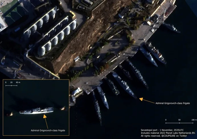
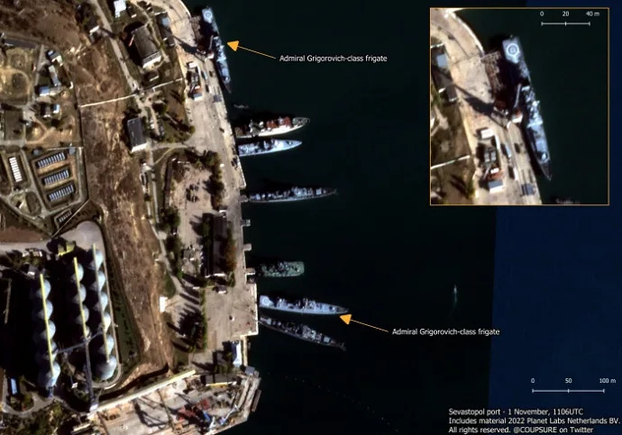
The first satellite images of Sevastopol Bay have appeared since the so-called "drone attack" on warships of Russia’s Black Sea Fleet in temporarily occupied Crimea on 29 October.
Source: Ukrainian military blog Militarnyi, citing OSINT analyst Benjamin Pittet
Details: The pictures were taken on 1 November at 05:35 and 11:06. The satellite recorded an Admiral Grigorovich-class frigate in tow on the high seas. Five hours later, the ship was at the mooring wall of Striletska Bay in Sevastopol.

According to Militarynyi, it is possible that the photo recorded the movement of the Admiral Makarov frigate. The nature of the alleged damage from the "drone attack" cannot be established from the photo.

Background:
On 29 October, explosions were reported in the Russian-occupied city of Sevastopol on the Crimean peninsula; Russian ships were allegedly "repelling a drone attack".
The Russian Ministry of Defence claimed that the Armed Forces of Ukraine had attacked Sevastopol with drones at 04:00 on 29 October. The Russian Defence Ministry confirmed that the Ivan Golubets minesweeper had been damaged. It claimed that preparations for the "attack" on Sevastopol were carried out under the guidance of members of the British Navy, who are allegedly currently in the Ukrainian city of Ochakiv.
Ukraine’s southern defence forces suspect that failed launches of air defence missiles by the Russian invaders could be the reason for the explosions in Sevastopol on Saturday.
GeoConfirmed investigators reported that at least three ships of the Russian Black Sea Fleet, including the flagship Admiral Makarov, were damaged as a result of the unmanned surface vessel (USV) attack on 29 October.
The Institute for the Study of War has suggested that the attack was carried out by Ukrainian forces.
No comments:
Post a Comment