Floods Of The Irrawaddy: Anthropogenic Catastrophe Disguised As Natural – Analysis
By Shwetaungthagathu Reform Initiative Centre
By Thuta Aung
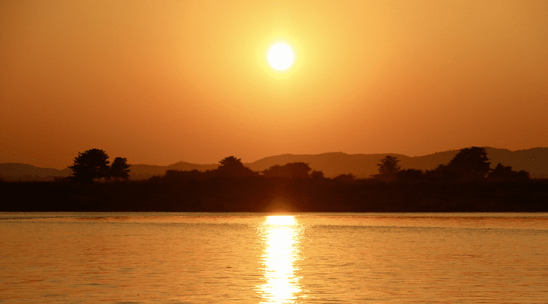
The Irrawaddy became home to frequent disastrous floods, exceeding its natural phenomena, and more likely due to human factors, threatening the residents.
Key Takeaways:
- The Irrawaddy River is a critical geographic feature of Myanmar and is less favorable for floods. But the recent floods are much intense than the past.
- Environmental degradation, climate change, governance practice, and infrastructure development patterns shape the current floods of the Irrawaddy.
- Without adequately addressing these issues, this type of disaster has a considerable portion of human error and will broadly impact the likelihood of people in Myanmar.
Born in Kachin State by merging the N’Mai Hka and Mali Hka, running through from north to south, along central Myanmar, and merging with the Andaman Sea, where it forms the delta that is intruding 50m per year into the sea by depositing the sediments it carries. Irrawaddy has a centuries-long history and has been a vital bloodline of Myanmar for centuries. The waterway shapes the country’s history, culture, economy, and social structure.
Geography and the issue
The Irrawaddy is a through-flowing river, dating back to the late Oligocene, comprising upper, central, and lower parts that cover an area of up to 410,000 square kilometres. As the monsoons present, where 70% of its freshwater discharge occurs, which imposes floods on the river, it was less intense than it is nowadays as the topography is less prone to flooding due to vast floodplains, geological structure, and gentle slopes throughout its path, and dense vegetation in its vulnerable upper part.
Nonetheless, in recent years, the floods of the Irrawaddy have become more severeand frequent. Exceeding the natural factors, but the result of environmental degradation, governance errors, conflicts, and climate change, forcefully triggers the destructive floods of the Irrawaddy.
Ecosystem Disruption
The ecosystem balance is critical for a river, and the Irrawaddy was in good health for a long time. But between the late 20th century and the early 21st century, the upper portion of the river in the Kachin region has lost 379kha from 2001 to 2024, accounting for 69% of the total tree loss during these years, while the country deforestation rate was between 1% to 2.5% of its forest area annually. Remote-sensed data point out that most of the deforestation occurs at the banks and vicinity of the main inlets of the Irrawaddy due to the ease of transportation. Being the first state in the country to have a deforestation rate, it triggered topsoil erosion mechanisms, causing reduced absorbability of the soil and root system destruction, where a single tree can absorb up to 15 gallons of water. The soil erosion also boosts the silting rate, causing the river-bed to shallow and increasing the probability of floods.
Apart from it, the infamous mining activities exacerbate siltation rate, as the third largest exporter of rare-earth minerals, primary producer of jadeite, and also gold mining, with uncontrolled and unethical extraction methods, fuel the potential of Irrawaddy flooding by increasing siltation and indirectly by deforestation for mining practices. Moreover, urbanization, forced relocation, and poverty ledresidents to extract resources from forests, causing forest degradation. As the water catchment basin diminishes, combined with a high siltation rate, it causes flash floods in the upper part of the river, and reaches an alarming point just after the monsoon. As these factors play out, flash floods are not the only case; the region has been suffering from fluvial floods for weeks. After the water level had fallen, the silt was still problematic. The move-out water body eagerly came down along the river, establishing the mentioned flood mechanism throughout its way to the sea.
Climate change
Climate change, an unstoppable global phenomenon, contributes to devastating floods, especially in tropical regions. In the case of the Irrawaddy, three factors play a role: glacial melting, heavy rainfall, and tropical cyclones. The Irrawaddy is formed by merging two rivers from the Himalayan ranges fed by glaciers. As global warming intensifies, the rate of glacial melting accelerates, increasing runoff into the Irrawaddy and heightening flood risks. Global warming also raises sea levels and increases evaporation and precipitation rates, as hotter air holds more moisture, leading to heavier downpours and more intense cyclones, which are projected to grow from 2% to 11% by 2100.
Regarding tropical storms, the likelihood of their formation has increased by 0.19 per year over 42 years. Myanmar’s topography makes it highly vulnerable to cyclones, which account for 12.35% of natural hazard threats. Flooding from cyclones affects the Andaman Sea and the South China Sea, bringing excessive rainfall. In 2024, the Typhoon “Yagi” caused widespread flooding as it approached land, with Myanmar suffering significant impacts due to heavy rains. The intense rainfall overwhelms catchment areas, causing backwater floods, fluvial floods, and flash floods.
Governance
Although the development of Myanmar has mainly relied on the Irrawaddy for centuries, the governments, especially in the post-independence era till now, when the use of the Irrawaddy and its ecosystem has changed, have failed to build a policy for the Irrawaddy. After independence, Myanmar’s governments, ethnic groups, and long-term civil war heavily shaped the river. During the colonial era, their forest conservation along the Irrawaddy was effective and practical, at least compared to after independence. After 1948, the civil war began, and all parties started exploiting resources from their territory to drive the war, causing much destruction to the river. Especially, after the military took over in 1990, when they boosted the jade production. The small-scale and artisanal mining practices were transformed into heavy machinery, exploring jade with uncontrolled mining techniques, which fed the silt into the Irrawaddy. Still, not limited to, also into the major tributaries of it, and that also caused abnormal residing in the forest area, contributing to deforestation.
On the other hand, the conservation of the Irrawaddy is nearly nonexistent; the headwaters, the river basin, tributaries, and delta region are almost uncontrolled, and agricultural practices along the river lead to sedimentation, point bar formation, riverbed shallowing, and increased potential for floods. The military junta regime’s political isolation has made the country economically dependent on natural resource exports, preventing any consideration of conservation. The controversial, well-known Myit Sone Dam construction and other water resource management projects were solely aimed at resource extraction, not conservation. During the democratically elected NLD government era, the military and armed groups undermined efforts to limit resource extraction due to their interests. The situation has worsened after the coup, as the military and its allied militia, along with other ethnic armed groups, have their eyes on resource-rich areas. The expansion of rare earth elements (REE), valuable minerals, and timber production threatens the country’s sustainability, including the Irrawaddy. A resource curse is inevitable if the military regime maintains control long-term and conflicts continue.
Infrastructure Development
Infrastructure development is critical to sustainable water use and waterway management. In this case, Myanmar is far behind. Although the Irrawaddy was used for irrigation, transportation, and trade, the infrastructure projects built on the waterway were primarily designed to collect and contribute water, rather than to prevent floods or mitigate possible natural disasters. Although hydropower plants are proposed, there is no proper sediment management system. For instance, in Mandalay, where Irrawaddy turns sharply to the west, the erosion rate is higher, and point bar formation disrupts the waterway, the river bank protection is inadequate, depending on the decade-old embankment, which is just compacted soil type and has found deformation and soil instability after the March 27 Earthquake. Thus, the city still faces and is prone to floods, worsened after the military coup. This phenomenon is the same throughout its passage and threatens the community residing on the riverbank. In the delta region, which is vulnerable to many climate-related disasters, the preventative measures are still lacking. However, there are 10 water-related ministries, and support is available from foreign agencies like JICA.
The National Natural Disaster Management Committee was formed under the National Disaster Management Law and boosted under the NLD government era. After the coup, the committee was ignored by the junta, and the allocated funds were unlawfully used to prop up the economic sanctions. Therefore, when floods have been frequent in recent years, the disaster relief program heavily relies on civil service organisations. Even the basic transportation network is sensitive to disasters, and combined with ongoing conflict, the relief aid is not easy to reach. The telecommunication ensures connection only in and around major cities, and barely reaches remote locations, reducing accessibility to the information. Rural and urban expansions are not considered flood risks due to the overloaded population density in urban areas and profit-oriented business style in rural regions, which puts the people who reside in those regions at risk of disasters, including floods.
Myanmar’s major waterway has become prone to severe and frequent floods due to resource extraction, climate change, governance, and development; these floods are increasingly seen as man-made disasters rather than natural events. The situation calls for a sustainable solution from all stakeholders, or the river “Irrawaddy” will continue to cause destructive flooding for its people now and in the future.
- About the author: Thuta Aung is a Research Assistant at the Sustainability Lab of the Shwetaungthagathu Reform Initiative Centre (SRIc), holds a B.Sc. in Geology, and is currently pursuing Environmental Science at Chiang Mai University, Thailand.
- Source: This article was published by The Sabai Times
Shwetaungthagathu Reform Initiative Centre
The Shwetaungthagathu Reform Initiative Centre (SRIc) is a hybrid think tank and consultancy firm committed to advancing sustainable development and promoting sustainability literacy in Myanmar. Through its Sustainability Lab, SRIc conducts public policy research and analysis to promote Sustainable Development in Myanmar and guide the country toward a sustainable future. SRIc also offers consultation, CSR strategy development, and Sustainability roadmaps focused on Environmental, Social, and Governance (ESG). SRIc equips individuals and organizations with actionable strategies for sustainable growth through capacity-building programs, customized training, publications like Sabai Times, and outreach initiatives such as webinars and podcasts. By merging research insights with practical consultancy, SRIc fosters responsible business practices, develops CSR strategies, and creates sustainability roadmaps, contributing to local and global sustainability efforts.
No comments:
Post a Comment