Icebreaker's cyclone encounter reveals faster sea ice decline

IMAGE: THE KOREAN ICEBREAKER ARAON, WHICH UNEXPECTEDLY FOUND ITSELF IN AN ARCTIC CYCLONE IN 2016, UNLOCKED THE KEY TO HOW THESE STORMS WREAK HAVOC ON SEA ICE IN THE ARCTIC OCEAN. view more
CREDIT: PHOTO BY JOO-HONG KIM, KOREA POLAR RESEARCH INSTITUTE
In August 2016 a massive storm on par with a Category 2 hurricane churned in the Arctic Ocean. The cyclone led to the third-lowest sea ice extent ever recorded. But what made the Great Arctic Cyclone of 2016 particularly appealing to scientists was the proximity of the Korean icebreaker Araon.
For the and their international colleagues recently published a new study showing that sea ice declined 5.7 times faster than normal during the storm. They werefirst t me ever, scientists were able to see exactly what happens to the ocean and sea ice when a cyclone hits. University of Alaska Fairbanks researchers also ab and their international colleagues recently published a new study showing that sea ice declined 5.7 times faster than normal during the storm. They were e to prove that the rapid decline was driven by cyclone-triggered processes within the ocean.
"Generally, when storms come in, they decrease sea ice, but scientists didn't understand what really caused it," said lead author Xiangdong Zhang from the UAF International Arctic Research Center.
There was general speculation that sea ice declined solely from atmospheric processes melting ice from above. Zhang and his team proved this theory incomplete using "in-situ" observations from directly inside the cyclone. The measurements reflected things like air and ocean temperature, radiation, wind and ocean currents.
It was a stroke of good luck for science, and perhaps a bit nerve-racking for those onboard, that the icebreaker was in position to capture data from the cyclone. Usually ships try to avoid such storms, but Araon had just sailed into the middle of an ice-covered zone and was locked in an ice floe.
Thanks to the ship's position so close to the storm, Xiangdong and his team were able to explain that cyclone-related sea ice loss is primarily due to two physical ocean processes.
First, strong spinning winds force the surface water to move away from the cyclone. This draws deeper warm water to the surface. Despite this warm water upwelling, a small layer of cool water remains directly beneath the sea ice.
That's where a second process comes into play. The strong cyclone winds act like a blender, mixing the surface water.
Together, the warm water upwelling and the surface turbulence warm the entire upper ocean water column and melt the sea ice from below.
Although the August storm raged for only 10 days, there were lasting effects.
"It's not just the storm itself," explained Zhang. "It has lingering effects because of the enhanced ice-albedo feedback."
The enlarged patches of open water from the storm absorb more heat, which melts more sea ice, causing even more open water. From Aug. 13-22, the amount of sea ice in the entire Arctic Ocean declined by 230,000 square miles, an area more than twice the size of the state of Arizona.
Xiangdong is now working with a new computer model for the Department of Energy to evaluate whether climate change will lead to more Arctic cyclones. Previous research shows that over the past half-century, the number and intensity of cyclones in the Arctic have increased. Some of those storms, like the biggest Arctic cyclone on record in 2012, also led to record low sea ice extent.
###
Additional co-authors for this paper include two University of Alaska Fairbanks graduate students, Liran Peng and Han Tang, along with Korean researchers Joo-Hong Kim, Kyoung-Ho Cho and Baek-Min Kim, and Zhaomin Wang from China.




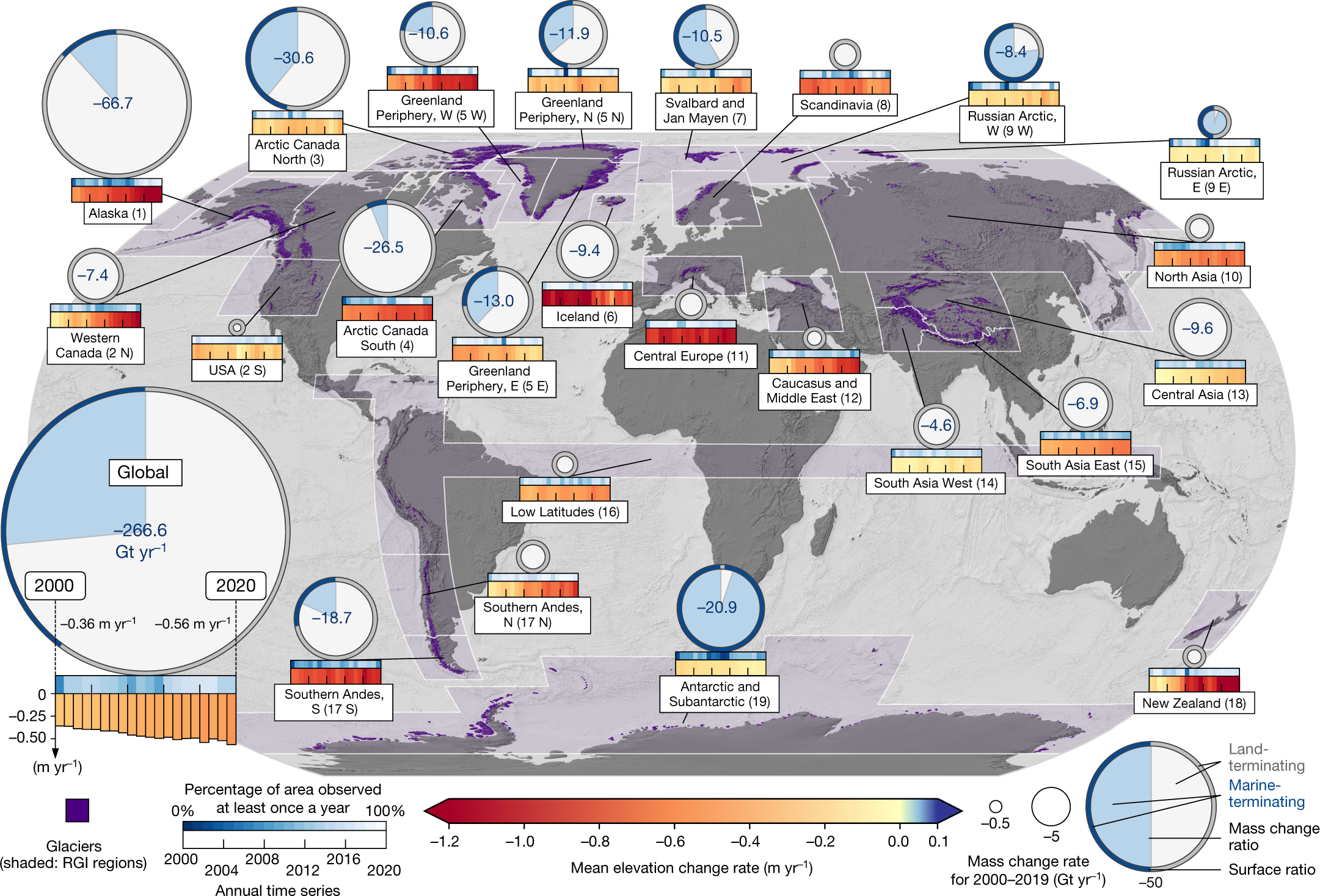 Regional and global mass change rates with time series of mean surface elevation change rates for glaciers. (
