British Columbia·Photos
Before-and-after satellite images show flood devastation in B.C.'s Sumas Prairie
Historic rainfall flooded farm fields, forced evacuations and killed livestock

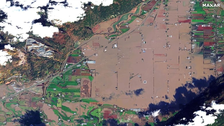
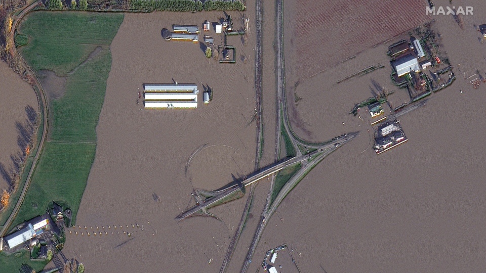
Dramatic satellite images show the extent of flood damage in B.C.'s Sumas Prairie following last weekend's historic rainfall.
The low-lying rural area, east of Abbotsford's town centre, is mostly farmland and was created by the draining of Sumas Lake in the 1920s.
Last week the area suffered extensive flooding as water gushed in from the Nooksack River from neighbouring Washington state, forcing evacuations and killing livestock.
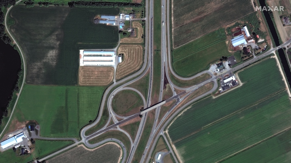
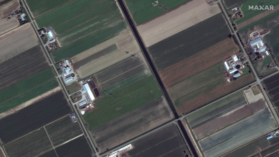
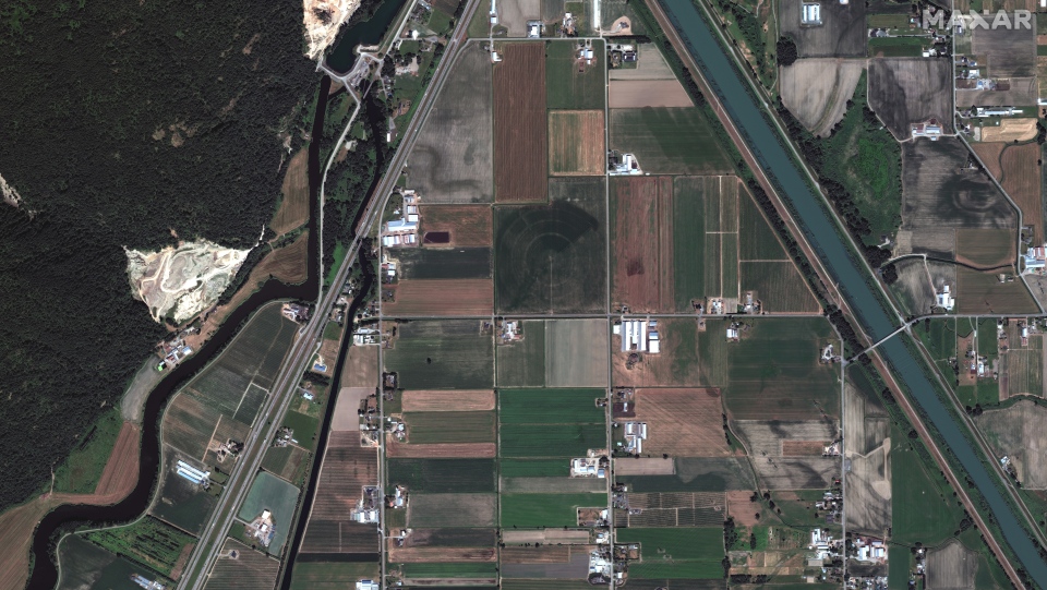
In images provided by Maxar Technologies, farmland in the region is shown on June 27 this year and again on Friday.
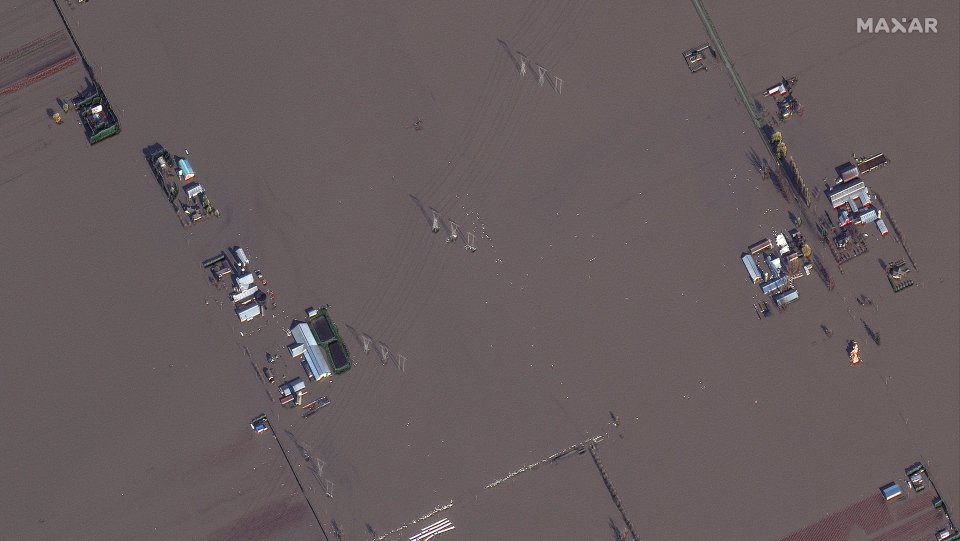
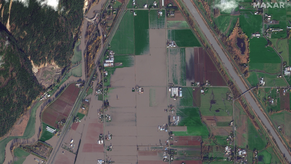
Many homes, barns and roads were left submerged under murky brown water following the storm, as seen in the composites above and below.


A pilot who has been helping to bring supplies to affected communities in the region told CBC News on Monday that the Hell's Gate Airtram attraction in the Fraser Canyon area was "gone" following the storm, but the company said on Tuesday this is not the case.
Maintenance staff were on site at noon Tuesday and confirmed the airtram is intact, the management team said. They also noted the staff took a picture of it, which was posted to the company's Twitter page.
When reached on Tuesday, the pilot, Shaun Heaps, said he was relieved by the news, adding that when he flew over Hell's Gate he couldn't see it.
Recovery efforts continue
More troops arrived in the province over the weekend to help farmers in the Sumas Prairie area save livestock and lend a hand in sandbagging efforts.
On Saturday, the mayor of Abbotsford told a news conference that round-the-clock work has improved the flooding situation in the region.
Flood gates at a pump station that has struggled to keep up with the influx of water in Sumas Prairie were able to partially reopen, allowing excess water from the Sumas River to flow into the Fraser River, said Mayor Henry Braun.
"There's a dramatic change already in certain parts of the prairie," said Braun. "I can visually see a lot of green fields."
But with more rain expected in the coming week, Braun has extended a local state of emergency until Nov. 29.
See more of the flood damage in the region (all images taken on Friday):


Corrections
- A previous version of this story quoted a pilot saying the Hell's Gate Airtram "is gone" due to the floods. The company has since told CBC News that the airtram is still intact.Nov 23, 2021
Ben Cousins
Tuesday, November 23, 2021
TORONTO -- Satellite imagery from before and after the flooding in British Columbia reveal the true devastation the region has experienced.
The images from Nov. 19, provided by the satellite company Maxar Technologies, shows vast areas of green farmland in the Sumas Prairie near Abbotsford, B.C. that are now covered in what appears tobe murky brown water.
Some of the before images also show buildings and highways that are nearly unrecognizable in the second images.
The flooding situation in the Sumas Prairie has improved since these images were captured. On Tuesday, Abbotsford’s evacuation order was downgraded to an evacuation alert as the water levels receded in the area.
The downgrade meant that some residents were allowed to return to their homes. An update from city and provincial officials is expected later Tuesday.
In other parts of B.C., residents are also seeing an improvement. In Merritt, some residents were allowed to return home after the entire community was evacuated last week,
CN railways are expected to resume “limited” service in southern B.C. tomorrow after flooding and mudslides damaged the rail line.
(Satellite image ©2021 Maxar Technologies)
(Satellite image ©2021 Maxar Technologies)
(Satellite image ©2021 Maxar Technologies)
(Satellite image ©2021 Maxar Technologies)
(Satellite image ©2021 Maxar Technologies)
(Satellite image ©2021 Maxar Technologies)
RELATED IMAGES

Images from Nov. 19 show vast areas of green farmland in the Sumas Prairie near Abbotsford, B.C. that are now covered in what appears to murky brown water. (Satellite image ©2021 Maxar Technologies)

Images from Nov. 19 show vast areas of green farmland in the Sumas Prairie near Abbotsford, B.C. that are now covered in what appears to murky brown water. (Satellite image ©2021 Maxar Technologies)
No comments:
Post a Comment