Wednesday, June 10, 2026

ARCHAEOLOGY

The Mirror Of Neolithic Art: How Çatalhöyük Confronts The Hubris Of The Modernist Perspective – Analysis


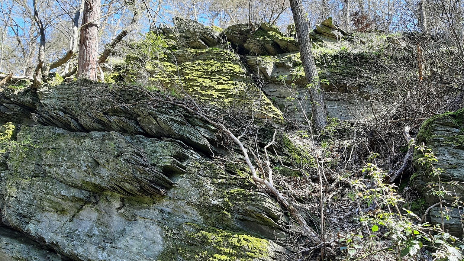
The famous wall painting from Çatalhöyük depicts tightly clustered domestic houses beneath an erupting volcano. Photo/Illustration by Asya Denk.


June 10, 2026 
By Erdem Denk

The theme for an exhibition that opened on June 4, 2026, at Ankara University’s Faculty of Political Science (Mülkiye), World’s First City Plan/Map, as part of my Arkeopolitics initiative, was met with reservations by a group of students from the Middle East Technical University’s faculty of architecture.They questioned how the map—exhibited in the Çatalhöyük section of the Museum of Anatolian Civilizations—could be called a work of art, reflecting the flawed modern perspective.

A young architect candidate objected and said: “Professor, how can this be a map? The houses are seen from above the (plan), but the mountain is seen from the profile (section). There is a serious perspective error here. Furthermore, a ‘mind’ capable of drawing a map could not have developed in that period.”

“In that case, should we also consider Picasso’s works irrational?” I responded.

Even though the hubris of the modern mind did not show at that exact moment, it was actually an “aha!” moment, the impact of which has been felt over time.


The people of Çatalhöyük depicted the world not “as it is”—in the sense we claim to understand today—but “as they felt and conceptualized it.” The truth is that the rational, perspectival gaze, or what we call “as it is,” is nothing more than a form that the modern mind “feels and conceptualizes” the world through. Therefore, the map is a work of art within its own period and context.
The Çatalhöyük Gaze

That bird’s-eye view that we see through drones today was a daily reality for the Çatalhöyük residents. In a settlement with no streets, where entry to houses was through roofs, life flowed on the rooftops. Socializing, working, and playing took place in the shared public space stretching across the roofs. Thus, the artists drawing the city depicted it from the angle they knew best—from above—and it was not a technical inadequacy or deficiency; on the contrary, it was sociological honesty. In fact, the equal stature of all the houses in the drawing also revealed the egalitarian structure of the settlement. They simply did not know (and see!) it any other way.

As for the mountain being shown from the front, besides its conformity to human vision and reality, it points to a colossal shared/natural constant that either threatened the entire city and/or held it at its skirts to give it its identity.

The claim that the “mountain” was the well-known “leopard skin” was also quite popular for a time, partly fueled by the notion that it could not be a map (so much so that Stephanie Meece wrote in her article that attributing cartography, which she deemed a Western phenomenon, skill, and invention, to Çatalhöyük was absurd). However, other studies replicating how a leopard skin is cut and splayed open have largely marginalized this view. Besides, a shape that erupts is highly likely to be a mountain. Today, we know that Mount Hasan, which looms on the horizon of Çatalhöyük, erupted while the Çatalhöyük settlement existed. We also know that obsidian, the industrial raw material that gave the settlement its character, came from it and other volcanoes in the region.

In short, nothing could be more natural than for the “mountain”—with its socioeconomic and sociopsychological significance for the settlement—to shape the art of the period, including the way it was depicted. Especially considering the importance a mountain (and a cave) held in almost all societies, from Upper Paleolithic shamanism to monotheistic religions.

The only significant complication here lies in the perspective of the depiction: the higher of the mountain’s two cones appears on the right side of the wall painting, whereas it is actually on the left when looking directly from Çatalhöyük, which is located just more than 100 kilometers away from the mountain. Crucially, this higher cone appears on the right only when viewed from Aşıklıhöyük—the pioneering settlement situated almost at the very foothills of the mountain. Given the roughly 150-year historical transition between the two sites, a direct cultural representation from Aşıklıhöyük seems unlikely. Alternatively, since geological hypotheses suggesting a later structural shift or eruption-induced alteration in the crater’s topography are highly implausible, it is far more rational to consider this specific rendering as the perspective or narrative of those who might have traveled directly to the base of the mountain for obsidian extraction.


In this sense, instead of capitulating to the modernist perspective that strips the painting of its cartographic value just because it lacks contemporary conventions, this composition should be recognized as a map in its own right—one that perfectly served the practical and existential needs of its own era. Much like the widely discussed interpretations of Upper Paleolithic cave art—where non-hunting depictions of animals are viewed as markers tracking seasonal paths, or where representations like the “Gargas hands” are interpreted as early “mapping” to signal game and demarcate secure travel routes—this rendering stands as a foundational cartographic practice: a vital transfer of a landscape’s economic and symbolic center of gravity onto a spatial plane.

After all, as we know from the enduring debates surrounding the Mercator projection, the modern era’s two-dimensional cartography is anything but an objective reflection of reality; by stretching the globe from the north, it systematically constructed a deeply Eurocentric worldview that we have long misconstrued as “normal.” Therefore, it is hardly surprising that the bewildered reaction of students seeing the Gall-Peters map on my office wall for the first time mirrors the same cognitive dissonance as the architecture student who confidently dismissed the Çatalhöyük painting for its apparent lack of “proper” perspective. It seems the modern mind simply cannot tolerate any reality that refuses to fit into its indoctrinated geometric grid.

The Relationship Between Art and Modernity


What is art? What about perspective and/or intellect? Or let us ask this way: Is the prescribed mode of thought that we call the perspective of the modern mind the only absolute way of seeing and showing reality? After all, wasn’t it the modern mind that warned us against unfalsifiable, single, and absolute truths?

Perhaps the real distortion belongs to the modern mind, which mistakes its own singular, rigid perspective for absolute objective reality. So, who is truly lacking perspective here? The Çatalhöyük artist who integrated multiple dimensions of lived experience onto a single wall, or the modern observer who looks at that wall and sees only a “technical error”?

Fortunately, we have mirrors like the Museum of Anatolian Civilizations in Ankara—where this unique wall painting is housed—and countless other institutions across every corner of the globe that safeguard the monumental heritage of the Paleolithic and Neolithic eras. These spaces invite us to break free from the shackles of the prescribed modern mind. That is, of course, if we are ready to accept what we so condescendingly label as “prehistory”—believing that history only begins when a society expresses itself through a script we happen to have successfully deciphered—is actually a rich history filled with sophisticated products of intellect and art. After all, Homo sapiens, who have existed for roughly 250,000 years—and the Neanderthals, who went extinct about 40,000 years ago—possessed art and engaged profoundly with their environments, both to share their narratives within, between, and beyond generations, and to survive in a symbiotic relationship with the spaces they inhabited.

A shorter version of this article was published in Turkish in Ankale Sanat, June 3, 2026. This article was produced by Human Bridges.

Author Bio:
  Erdem Denk is a professor of international law and international relations at Ankara University and the founder of the transdisciplinary research initiative Arkeopolitics, which integrates archaeology, history, political theory, and legal history to reinterpret the long-term dynamics of human societies. His research focuses on the evolution of law and social order since the Paleolithic. He is the author of The 50,000-Year World Order: Societies and Their Laws (2021, in Turkish) and is currently working on three books, in Turkish and English, titled When There Was No State, The Invention of the State, and The Story of the State.
View all posts by Erdem Denk →


Archaeological sensation: Iron Age Celtic grave discovered in Hesse

Slate outcrop on the Dombach, Bad Camberg
Copyright GerritR, Creative Commons Attribution-Share Alike 4.0 International license

By Nela Heidner
Published on

During surveys for a solar park in Hesse, archaeologists uncovered a Celtic princely tomb with exceptional grave goods near Bad Camberg, a find of European significance, according to Hesse’s state archaeologist Udo Recker.

During construction work for a solar park, a Celtic princely grave has been uncovered for the first time. Experts classify the discovery and the artefacts it yielded as exceptionally significant.

Among the grave goods recovered are several gold rings, an Etruscan beaked jug probably imported from what is now Tuscany in Italy, as well as the remains of weapons. Archaeologists also found traces of a two-wheeled wagon, including non-ferrous metal fittings from the wheel hubs and axle caps and iron tyre fittings. The finds suggest that the person buried there was probably a man, explained archaeologist Udo Recker.

The discovery makes it possible to prove “the previously only assumed presence of a local Celtic elite”.

Celtic wagon burial

The grave is now to be analysed using state-of-the-art investigative methods. The archaeologists hope this will provide new insights into the lives of people in the Iron Age more than 2,000 years ago.

Imaging techniques such as X-rays and CT scans point to further finds in the grave that still need to be uncovered.

The burial site can be dated to the middle of the first millennium before Christ. The find can be assigned to the so-called Hunsrück-Eifel culture.

According to the experts, it is one of the rare Celtic wagon burials. In Hesse only around three comparable graves are known to date – none of them matches the quality of the finds from Bad Camberg.

A completely different social structure

Compared with today, Celtic society was structured in a completely different way.

As the Celts left no written records, archaeologists and historians rely primarily on ancient accounts from Greek and Roman times and on archaeological finds. The Celts did not form a cohesive people or an early European nation, but in the Iron Age lived in numerous independent tribal groupings.

These groups were linked by a common Indo-European language family and by similar cultural characteristics, traditions, beliefs and ways of life. Out of the Bronze Age cultures of Central Europe developed the two defining Celtic periods: the Hallstatt culture (c. 650–450 BC) and the La Tène culture (c. 450–50 BC).

Politically, the Celts were organised in a decentralised way – there was no shared system of rule or overarching kings. In addition to tribal leaders and princes, druids played a central role as religious and intellectual authorities. They acted at the same time as priests, healers, teachers and judges.

The decline of the Celts did not happen abruptly, but over several centuries. Decisive above all was the expansion of the Roman Empire: many Celtic territories were conquered and incorporated into Roman rule, especially after the campaigns of Julius Caesar in Gaul in the 1st century BC.

Tribal confederations instead of a single community

Because the Celts lived in numerous independent tribal confederations and did not form a political unit, they were only able to oppose external powers to a limited extent. There was also a gradual cultural adaptation to the Roman way of life – language, administration and customs were adopted in many places. In other regions, Celtic groups were also displaced by Germanic tribes or integrated into new societies.

The Celts have not, however, disappeared entirely: in regions such as Ireland, Scotland, Wales and Brittany, Celtic languages and cultural traditions have been preserved. Today’s Celtic languages (such as Irish, Welsh or Breton) go back to this heritage.

The investigations of the current finds in Bad Camberg are being carried out jointly by experts from “Hessen-Archäologie”, the research centre of the Celtic World at Glauberg, and the Leibniz Centre for Archaeology in Mainz.


‘Putting biodiversity in our hands’: British wildlife will soon be celebrated on banknotes

A vote is currently being held to determine which animals to feature on the new banknotes.
Copyright Canva

By Angela Symons
Published on

Some say 'animal underdogs' have been left off the shortlist, which is now open to a public vote.

Historical figures like Winston Churchill will soon be replaced by native wildlife on UK banknotes.

In a public consultation run by the Bank of England, the theme of nature came out on top. The exact plants and animals that will be on the notes will be chosen later this year.

Nature is more than just scenery, it is the living thread that binds our landscapes, our history, and our future together,” says Scottish wildlife filmmaker Gordon Buchanan, who is part of an expert panel that has compiled the list, which is currently open to votes from the public. “To protect nature is to protect the quiet, resilient heartbeat of the land itself.”

Not only could the new notes inspire wildlife conservation, they’re also well positioned to protect the economy.

“The key driver for introducing a new banknote series is always to increase counterfeit resilience,” says Victoria Cleland, chief cashier at the Bank of England.

“Nature is a great choice from a banknote authentication perspective,” she adds, because it lends itself to developing security features that are easy for the public to recognise and distinguish.

A public vote will determine which animals and plants will be on the new banknotes.
A public vote will determine which animals and plants will be on the new banknotes. Canva

Symbolic recognition of UK wildlife ‘overdue and significant’

Nature was the most popular theme among 44,000 respondents in the July 2025 consultation, capturing 60 per cent of the vote.

It will replace the current historical figures featured on the reverse side of banknotes, which include writer Jane Austen, artist JMW Turner and scientist Alan Turing, as well as the WWII Prime Minister.

“This is a powerful reminder of how deeply people feel connected to and value British wildlife,” says Ali Fisher, founder and director of sustainability consultancy Plans with Purpose. “It’s a beautiful opportunity to put biodiversity literally in all our hands.”

Architecture and Landmarks was the second most popular at 56 per cent, followed by Notable Historical Figures (38 per cent), Arts, Culture and Sport (30 per cent), Innovation (23 per cent) and Noteworthy Milestones (19 per cent).

“The wildlife of the UK is not separate from our culture. It sits in our football crests, our folklore, our coastlines and our childhoods,” says wildlife presenter and activist Nadeem Perera, another panel member. “Giving it space on something as symbolic as our currency feels both overdue and significant.”

Which animals could feature on the new banknotes?

The RSPA has called for Britain's "least-loved" wildlife – such as pigeons, gulls and foxes – to feature on the new banknotes. The charity said this could help change perceptions of "misunderstood" animals and encourage people to see the value of all wildlife.

“What about the pigeons who have been our friends for thousands of years, or rats, with their amazing memories, or even gulls, with their amazing levels of intelligence?," says Geoff Edmond, wildlife expert at the RSPCA. "They are all fascinating wild animals in their own right – and deserve recognition too.”

While pigeons and rats didn't make the final cut, the red fox is an option alongside the pine marten, grey seal, European hedgehog, brown hare and bottlenose dolphin.

In the birds category, voters can choose between the Atlantic puffin, barn owl, common kingfisher, Eurasian curlew, great spotted woodpecker and white-tailed eagle. While the amphibians, insects and fish line up includes the Atlantic salmon, basking shark, buff-tailed bumblebee, common frog, emperor dragonfly and marsh fritillary butterfly.

"It's great that the Bank of England has pulled together a diverse shortlist... although we would love to see more animal underdogs make the cut," said Dr Ros Clubb, Head of Wild Animals at the RSPCA, following the announcement.

Norway’s krone series features images of the sea.
Norway’s krone series features images of the sea. Canva

From Norway to Switzerland: Which other European countries champion nature on their notes?

The Bank of England won’t be the first in Europe to give nature a place on its banknotes. Scottish notes already include animals such as mackerel, otters and red squirrels.

Norway’s latest krone series celebrates its long coastline by featuring wave motifs and Atlantic cod and herring.

Switzerland began shifting away from featuring famous personalities on its banknotes in 2016, with wind, water and light among the stars of its ‘many facets of Switzerland’ series. Butterflies, the Alps and dandelion seeds now grace its currency, with a new series set to double-down on native plants and Alpine landscapes in the 2030s.

Nature could also replace architecture on future euro banknotes, with the European Central Bank considering designs featuring birds and rivers across Europe.

Following a contest for EU designers to submit proposals in 2025, the shortlisted themes are ‘Rivers and birds: resilience in diversity’ and ‘European culture: shared cultural spaces’. A final decision is expected to be made in 2026.

“In a cost‑of‑living, climate and nature crisis, small cultural shifts like this matter,” says Fisher. “They help normalise the idea that our natural world is worth celebrating, protecting and investing in.”

France moves closer to ocean goals with three new marine protection zones

The French government has announced three new marine protected areas, bringing it a step closer to goals established at the 2025 United Nations Ocean Summit. These "strong protection" zones are situated in mainland France, in the French West Indies and the French Southern and Antarctic Lands.


Issued on: 09/06/2026 - RFI

A person swims near a whale shark off the coast of St. Helena in the South Atlantic Ocean in February 2025. © AP - Flora Tomlinson-Pilley

This brings to 14.68 percent the proportion of French maritime waters under strict protection, a designation that prohibits or strictly limits activities such as fishing, extraction, and tourism.

"We are moving much closer to the objective we set for ourselves at the UNOC (the United Nations Ocean Conference in June 2025) of reaching 14.8 percent by the end of this year," according to the Minister for Ecological Transition, Monique Barbut, who made the announcement alongside the Minister Delegate for the Sea and Fisheries, Catherine Chabaud.

Barbut was speaking at the opening of the "Neptune Forum," which aims to be the "Davos of ocean exploration," and which brought together scientific experts, diplomats, representatives of NGOs, and institutional leaders, on Monday in Paris.

It coincided with the UN World Oceans Day which carried the theme 'Reimagine: Beyond the world we know, a new relationship with our ocean'.

The three new marine zones encompass diverse parts of France's wide-reaching territory, including parts of the French Southern and Antarctic Lands (TAAF), where the seabed lies beyond 2,500 metres.

In Guadeloupe, the zone will protect coral reefs, home to sea turtles, while in the Bay of Audierne, off the coast of Finistère, the measures will protect a bird species known as the Kentish plover.

UN Summit advances ocean protection, vows to defend seabed

In December, France launched the "strong marine protection zones" label for 63 sites in its waters – taking a concrete step towards a pledge made in June 2025 at the UN Ocean Summit in Nice.

The sites include the Cordelière Bank in the Scattered Islands in the Mozambique Channel, the marine core of Port-Cros National Park in the Mediterranean and a reserve off the Île de Ré on the Atlantic coast.


Tackling plastic pollution

The Nice summit concluded with the ratification by 50 countries of the High Seas Treaty (known as the BBNJ), an international agreement designed to better protect international waters, representing half the planet.

"Today we have more than 90" signatory countries, stated French Ambassador for Oceans and Polar Affairs Olivier Poivre d'Arvor on Monday at the forum.

France rolls out 'strong protection' label for 63 marine areas

"Our goal (...) is to ensure that on January 11, 2027, in New York, at the United Nations, during the first COP of the Ocean, the COP of the High Seas, we have more than 120 countries around the table," he added.

Barbut and Chabaud also presented an action plan for combating plastic waste for the years 2026 to 2030.

"Every year, nearly 12 million tons of plastic end up in our oceans. The fight against plastic waste at sea was therefore one of the priorities of UNOC-3 and is a major issue for the health of marine ecosystems, from inland to coastal areas," according to a statement from the Ministry of Ecological Transition.


Divers made the first video ever of this shark in the Med - then got back to work on the real threat


By Denis Loctier
Published on 

Volunteer divers had the astonishing encounter while retrieving abandoned fishing nets from a shipwreck.

When Derk Remmers and other volunteer technical divers went on a mission to clear a ghost net-entangled shipwreck in the Mediterranean, they witnessed something astonishing.

As they descended roughly 40 metres between Sicily and Tunisia, a large great white shark emerged from the blue.

Derk scrambled for his camera, capturing what is believed to be the first underwater footage of an adult great white shark ever filmed in the Mediterranean in its natural habitat. Rare surface sightings have occasionally been recorded in the region, but underwater encounters filmed by divers have never previously been known.

The great white shark filmed in the Strait of Sicily by Derk Remmers
The great white shark filmed in the Strait of Sicily by Derk Remmers Healthy Seas/SDSS/Ghost Diving

The unique encounter occurred during a ghost net removal mission organised by the Healthy Seas Foundation together with Ghost Diving and the Society for Documentation of Submerged Sites (SDSS), who shared the footage with Euronews Earth.

"We were all a bit shocked - and amazed," Derk Remmers, a volunteer technical diver and head of Ghost Diving's German chapter, tells Euronews Earth. "My fingers were trembling, that's for sure - it was a big animal and we didn't expect this at all."

My fingers were trembling... We didn't expect this at all.
 Derk Remmers 
Technical diver, Ghost Diving

The shark circled the group before apparently losing interest. "He swam by and then he turned around and faced us and came back. It seemed clear that he was curious and not aggressive - he was really laid back, like he had the attitude of being the boss down there. And when we started releasing a few bubbles from our mouth, he started speeding up a little bit and vanished into the blue," recalls Derk.

Marine biologists consulted after the mission described the sighting as highly unusual and scientifically valuable. "Most of our knowledge on white sharks in the Mediterranean comes from records of dead specimens caught by fishing operations. Observations like this are extremely valuable for improving our understanding of the distribution, habits, and behaviour of this critically endangered species," said Dr Carlo Cattano, researcher at the Sicily Marine Centre of the Stazione Zoologica Anton Dohrn, in a statement released by Healthy Seas.

Ghost nets: A silent killer

The shark was extraordinary. The reason the divers were there was - sadly - not.

The Strait of Sicily is one of the most heavily exploited fishing areas in the Mediterranean, and the shipwreck the team was targeting had been accumulating ghost nets - fishing gear lost or abandoned at sea - for years.

Ghost nets do not stop fishing simply because no one is pulling them. Entangled on underwater structures like reefs and wrecks, they continue to trap and kill marine life indefinitely.

"They are made to kill fish and they still do that when they're not attached to the fishing boat anymore," Derk tells Euronews Earth. "Year by year, the amount of nets caught on this wreck gets bigger and bigger."

A dead turtle entangled in a ghost net
A dead turtle entangled in a ghost net Healthy Seas/SDSS/Ghost Diving

Previous dives at the site had already documented loggerhead sea turtles and large fish species trapped in abandoned gear. The team recovered sections of net on this mission as well, which will either be discarded safely or, where possible, recycled.

The scale of the problem extends far beyond any single wreck. "Between one to 10 per cent of all fishing gear of all fishing vessels in the world gets lost every given year," says Derk. "This might add up to more than half a million tonnes per year."

The shark's presence was a stark reminder of the scope of this threat, which echos through the entire marine food web.

"We feel somehow blessed to have this encounter, which also shows us the importance of our work," says Derk. "Because if a predator like that is hunting close to this wreck, that also means that there's a big amount of fish and a big amount of animals he could hunt there. And if they are trapped, there's also a chance we trap some of these predators. And if we trap them - there are only very few around there - that would be a big disaster."

A Ghost Diving volunteer removing an abandoned fishing net from the wreck
A Ghost Diving volunteer removing an abandoned fishing net from the wreck Healthy Seas/SDSS/Ghost Diving

A problem that needs more than divers

Derk is clear that volunteer clean-up operations alone cannot solve the ghost net crisis. "We can only do so much - we are only a few people," he tells Euronews Earth. "One thing is to remove the nets, which is the least we could do as humans. But it's also our idea to inform the public about this problem, so that work can be done before we need to collect the nets."

That upstream work, he argues, means confronting illegal and large-scale industrial fishing head-on. Family-run fishing businesses, he notes, have strong incentives not to lose gear - a lost net is an economic disaster for a small operation. It is industrial and illegal actors, operating at scale, who pose the greatest threat to the ecosystem.

"We should, as humans and as Europeans, try to enable our politicians to work against this threat and be more careful about our environment underwater," urges Derk.

The mission also included environmental DNA sampling and underwater monitoring to improve understanding of the species present around the wreck. Further analysis is expected in the coming months, with additional footage and scientific material to be released.


Vietnam’s Construction Boom In Disputed Spratly Chain – Analysis


A Vietnamese outpost in the Spratlys, May 2024. Photo Credit: RFA

June 10, 2026 
RFA
By Noh Jung Min

Vietnam is building military and maritime infrastructure at 27 sites across at least 18 reefs in the disputed Spratly Islands in the South China Sea, satellite imagery analyzed by Radio Free Asia revealed.

The improvements include ports, runways, military facilities and communications arrays that will improve Hanoi’s maritime and airspace awareness, experts told RFA.

“Hanoi is likely hoping that this development will deter Chinese action against Vietnamese economic activity at sea, including fishing and offshore oil and gas,” Harrison Prétat, deputy director of the Washington-based Asia Maritime Transparency Initiative, or AMTI, told RFA.

The Spratlys are a strategically critical and heavily contested archipelago comprising more than 100 small islands and reefs claimed wholly or in part by China, Vietnam, the Philippines, Malaysia and Brunei. The region is vital for global trade and is rich in fishing grounds and potential oil and gas reserves. No single nation holds universally recognized sovereignty over the islands.


Hanoi’s Objectives


Over the past decade, claimant nations — most notably China and, more recently, Vietnam — have engaged in extensive dredging and construction as a means to increase their footprint in the disputed territories and to bolster their claims.

Vietnam has been particularly aggressive in reclamation efforts, creating an additional 534 acres (216 hectares) of land across the archipelago over the past year, according to AMTI. This was in addition to the 2237 acres (905 hectares) it had already reclaimed over the past five years. The new reclamation areas undertaken in the second half of 2025 are on a much smaller scale as reclaimable areas become more scarce.

More than one project is active on some of Vietnam’s holdings in the Spratlys, including Cornwallis South Reef, Alison Reef and East London Reef.

The aggressive expansion in the Spratlys is Hanoi’s attempt to improve its ability to operate there, Lynn Kuok, the Lee Kuan Yew Chair in Southeast Asia Studies at the Washington-based Brookings Institution, told RFA.

“Vietnam is strengthening the logistical foundations of its presence in the South China Sea,” she said. “By expanding its network of harbors across the Spratlys, Hanoi is making it easier to move personnel, supplies and equipment between its occupied features and the mainland to sustain operations over longer periods.”

Monitoring the airspace

A key part of the new construction will help Hanoi to patrol the skies. At present Vietnam has a single 4000-foot (1,200-meter) runway on Spratly Island, the fourth-largest island in the Spratly chain from which the archipelago gets its name.

A new, much larger runway at Barque Canada Reef will stretch approximately 13,000 feet (4,000 meters) when it is complete.

In addition to the runway, Satellite imagery also confirms that a new communications structure has been installed — according to AMTI, it appears to be a Doppler VHF Omnidirectional Range (DVOR) navigation beacon that will likely provide accurate navigation for Vietnamese aircraft within 100 nautical miles of the island.

AMTI said similar beacons could be seen at the Spratly airstrips controlled by China.

“The navigation beacon at Barque Canada mainly serves to support Vietnamese aircraft navigating the surrounding areas of the South China Sea,” said Prétat. “I would only expect to see another DVOR beacon if they build another new airstrip, but we will likely see other types of communications and sensing facilities built on all the new outposts.”

The improvements to airspace infrastructure indicate a shift in Vietnam’s Spratly development, said Kuok. The first phase was land reclamation, and now the second phase, adding infrastructure to the enlarged islands and reefs, is underway.

“The installation of communications and navigation infrastructure should improve connectivity among the features Vietnam occupies and support aircraft operating in the South China Sea,” she said.

Insurmountable disparity


Despite the construction boom, Vietnam has no realistic path to matching China’s air capabilities, Prétat said.

Beijing already has four airstrips — at Fiery Cross Reef, Subi Reef, Mischief Reef and Woody Island — and will likely add a fifth at Antelope Reef. Additionally, Vietnam’s air force is far smaller and less technologically advanced than China’s.

“Hanoi is likely hoping that this will improve its ability to monitor its maritime areas and deter Chinese grey zone activity, but it won’t change the fact of China’s overwhelming military dominance in the South China Sea,” Prétat said.

China therefore retains substantial advantages in the Spratlys, with roughly twice as much reclaimed land, more extensive military infrastructure and overwhelming advantages in naval, coast guard and maritime militia capabilities, Kuok said.


Tit for tat?

RFA recently reported that Vietnam protested China’s land reclamation activities at Antelope Reef, but Prétat said China may have started those as a reaction to Vietnam’s Spratly expansions.

China’s construction of a new facility at Antelope Reef suggests Beijing wants to keep that gap sufficiently large — perhaps to signal to Vietnam and other Southeast Asian claimants that “catching up” is not an option. Beijing will do what it must in order to maintain its dominance in the South China Sea, he said.

Kuok said she is concerned that Vietnam’s fortification of features it occupies could create additional points of friction with Chinese forces and therefore increase the possibility of incidents or clashes.

But China’s disputes with Vietnam are less of a flashpoint than those Beijing has with the Philippines, she noted, adding that both Vietnam and China have strong incentives to prevent tensions in the South China Sea from spilling over into the broader bilateral relationship, which remains important economically and politically.

Prétat said that Vietnam’s position in the dispute is complicated by its broader relationship with China.

“Vietnam has been very proactive. They fought battles with China in the South China Sea, but they also have a very different set of international relationships,” he said. “On the one hand, they are one of the stronger voices on the South China Sea disputes, but on the other hand they have a unique relationship with China that they have to maintain.”

RFA attempted to contact both the Vietnamese and Chinese governments for comment on the ongoing construction in the Spratly Islands, but neither responded.


About RFA
Radio Free Asia’s mission is to provide accurate and timely news and information to Asian countries whose governments prohibit access to a free press. Content used with the permission of Radio Free Asia, 2025 M St. NW, Suite 300, Washington DC 20036.
View all posts by RFA →