ALIEN HEAT MIGRATION
US weather warning: America faces 'plume after plume' of Mexican heat as 100F forecast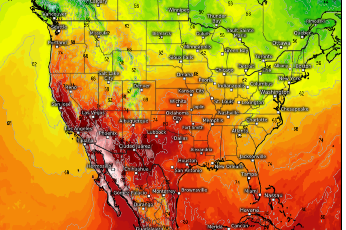
Summer is about to make a searing return to swathes of America
By Emily Fox
Published: 16/10/2023 -
Summer is about to make a searing return to swathes of America as ‘plume after plume’ of Mexican heat pushes temperatures to 100F.
Western states are about to head back into the furnace with a freak turnabout to trigger a mid-autumn heatwave.
However, while ‘west will be best’ the east may ‘get the beast’ with colder conditions forecast on the other side of the country.
Texas, Nevada, Arizona, California and New Mexico will be first to feel the lick of the flaming tongue of fire, according to experts.
Jim Dale, US weather correspondent and meteorologist for British Weather Services, said: “These states are going right back to square one after a bit of a respite from the heat, and through the start of the week we are looking at plume after plume of hot air pushing temperatures in some regions into the mid- to high-30Cs.

But for many once again, it is going to be unusually hot
WX Charts
“This hot tongue is coming up from Mexico and across the western part of the United States.
“But while, if you like the heat, the best will be the west, the beast may be coming to the east with cooler or colder conditions around New England.”
Warm and cold air will collide triggering outbreaks of rain as airmasses tussle at the mid-point, he warned.
He said: “There are two distinct weather masses on either side of the country, and where these meet there is the potential for some precipitation.
“The main threat of rain will be later in the week, though, with the significant issue affecting the US after the weekend being the very hot weather in the west.
“For places like Texas, this will be the latest in what has been a relentless spell of hot weather.
“They have had a bit of a breather, but as we go through the start of the week, temperatures are going to start heading back upwards.”
Temperatures across eastern states may drop low enough to prompt chilly residents to stoke up the autumn fires.
Storms tracking the country have dragged a swath of cooler air into some states leading to the east-west split.
The Weather Channel meteorologist Ari Sarsalari said: “We have had a storm system working across the country and we have been talking a lot about the precipitation associated with it, but there is a lot of really cold air on the backside of it.
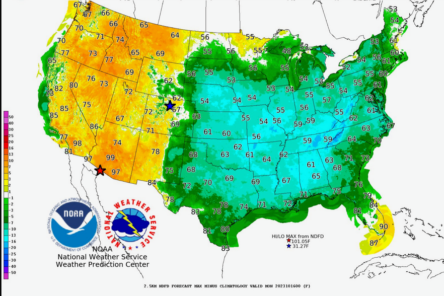
Temperature contrast across the US
NOAA
“Early next week, we're going to see some seriously cool air, where a big trough is going to take out to the planes and the eastern US.
“I am glad I got my chimney swept out a couple of days ago, as we're going to be having some fires for sure.”
Meanwhile, the Atlantic hurricane season rages on apace with Tropical Depression Sean paving the path for yet another potential storm to develop this week.
While Sean is not expected to reach the US, meteorologists continue to keep their eyes on an unusually busy Atlantic storm season.
A spokeswoman for The Weather Channel said: “Sea temperatures are warm enough for sustaining a storm.
“Sean is likely to become a remnant low to a depression, and the next name on the list is Tammy.
“We only have two storms after that, and this year if we get through all the names, we will actually go to an alternate list of names from the hurricane centre.”
No comments:
Post a Comment